Hello GeoRabblers!
The wheels are in motion and we are rolling back into town with another round of maps, laughs and rather questionable spatial puns  No pitches, no pressure – just passionate geo-people sharing spatial stories, laughs, and maybe a canapé or two.
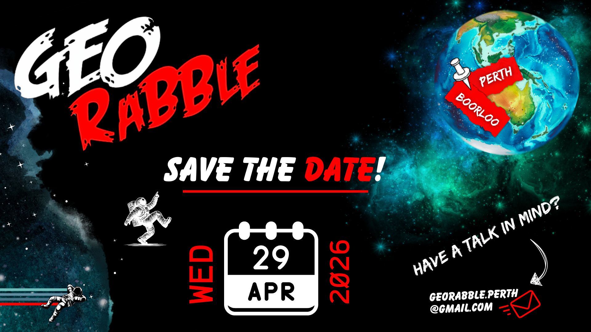
Ready your calendars  , engineer your AI agent prompts
  and head over this way now
  https://ti.to/georabble/georabble-perth-29-april-2026 to grab your registration!
We still have room for a couple of speakers too – so if you have an idea  , passion, story
  – from the whimsical to the technical – from the deeply technical, to the tech-adjacent – we’d love to hear from you! And if you’ve never presented before or would like to co-present with a friend/buddy, this is your time to shine – there is no better geo-community* to practice your speaking skills with and level up on your confidence!. Reach out to us at georabble.perth@gmail.com!
*high chance that we may be slightly biased
Event Details:
- Date: Weds 29th April 2026
- Time: Doors open at 5:00pm, the ‘rabblin starts at 6pm.
- Location: The Shoe, Yagan Square (Baby Shoe, upstairs)
- Format: Mixed bag of spatial goodness

Speakers:
- Mary Murphy – Beyond the maps: the power of connection
- Bryan Boruff – Why is (Re)development hot? Measuring Cumulative Heat in Australian Cities
- <more to come!
 >
>

We’d like to also extend the biggest of thanks to our amazing sponsor for bringing this event to life: Amristar!
Our events thrive thanks to the incredible backing of the Perth geo-community, and we couldn’t be more thankful for the continued generosity of sponsors across our industry.
To read more about GeoRabble Perth and previous events, head over here; and if you would like to unsubscribe or have received this email in error, please let us know*.
We look forward to celebrating with you all soon!
— Perth GeoRabble Crew
*We are {still} in the process of exploring mailing platform options and appreciate your patience while we go back to basics and advertise this event directly through email  & LinkedIn. If you no longer wish to receive GeoRabble Perth emails, please reply with ‘unsubscribe’ and we will remove you from the mailing list.