We have a surprise, last-minute guest speaker to announce!
Edie Bannerman, Youth Ambassador for Plan International Australia, will present their work on the “Free to Be Crowd-sourced Mapping Project” (http://planfreetobe.org/).
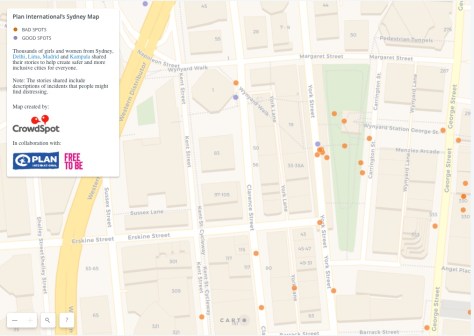
Through Free to Be, thousands of girls and young women in Sydney, Delhi, Kampala, Lima and Madrid have reported their experiences and shared their stories, to help create safer and more inclusive cities for everyone.
It’s not too late to register: https://www.eventbrite.com.au/e/georabble-sydney-returns-tickets-50670880969
Other speakers for GeoRabble Sydney: “The Unusual Suspects” are…
- Shesha Maheshwari: “GeoAI – How emerging technologies (such as mobile apps, smart wearables etc) use geospatial data for various purposes”
What the benefits are of such applications, as well as what their impacts are moving into the future – with a specific focus on the Cybersecurity/Information Systems Security Domain. - Hugh Saalmans: “Insurance, Customers, Disasters and Geo”
In March 2017, Cyclone Debbie damaged over $3bn worth of homes, businesses, farms and infrastructure along a 1000km long corridor – how did a big insurer, with thousands of customers impacted, use geospatial information to respond? - Roney Rodrigues: “From unprofitable cattle ranches to multibillion-dollar developments: All starts with… LiDAR!’
The use of LiDAR for architectural master plans and models, which have helped to raise funds from investors for the development of Costa Rica’s Pacific Coast. In both cases it is not the technical aspects of processing data or the final product that were generated. It’s all about creating solutions for customers that had no idea RS data could help them.
-
Chris Counsell: “Everyone’s a suspect”Maps have been popular for millennia. What’s different today is they’re online, and just about anyone can make them. The result is a true GeoRabble; dinosaurs, Monopoly, t-shirts and kids(?) games. We’ll take a look at some of the more unusual applications of GIS online and how your wildest GIS ideas aren’t that far away.
- Ian Hay: “Mapping Pacific Island slums and atolls: grounding geospatial methods in community-led approaches”
Presentation on some projects that we’ve done which have used drones, mobile data collection services, and have included ‘open’-ish spatial data protocols. They are international development projects in the Pacific regarding informal settlements (slums) and climate change vulnerability assessment, with a local village focus. The availability of new technology platforms has profoundly influenced our (spatial) work.
Registrations are now open: https://www.eventbrite.com.au/e/georabble-sydney-returns-tickets-50670880969
After too long an absence, we’re delighted to announce that GeoRabble Sydney will be back, on Thursday October 18th, from 6PM at the Occidental Hotel in York Street.
![]() As usual, entry is free, and there will be pizza (courtesy of HERE Technologies)
As usual, entry is free, and there will be pizza (courtesy of HERE Technologies)
Theme of this Rabble is “The Unusual Suspects” – celebrating the unusual, unsuspected, and surprising applications of geoinformation and -technology. Think using GPS for herding cattle, new uses of drones, photogrammetry in health, GIS on Mars, mapping in insurance and finance, to name just a few.

