Tag Archives: maps

BrisRabble – Only One Week to Go!

With only one week to go until the next Brisbane GeoRabble we are getting super excited to rabble…!

Announcing our first two speakers:

  • Stephen Kelly – GIS through the ages.
  • Stephen Donaldson – Cloud Anchors – The key to the Metaverse

{more to be announced soon!}

If you haven’t registered yet, head over this way: https://www.eventbrite.com.au/e/georabble-brisbane-9-return-of-brisrabble-tickets-76181606235

And if you’re keen to share your story with Brisbane geospatial community, get in touch! We still have a spot or two for speakers.

Thank you again to our sponsors for the night Benchmrk by Geolocarta and Go2Asset.

GeoRabble Perth #22 |It’s A Wrap!

Perth ‘rabblers kicked off the first GeoRabble of 2019 in style, with one of the biggest turnouts we’ve had in a long long time.

MC’d by the ever talented Damian Shepherd, who helped keep our speakers (and audience!) in check.

The evening started off with Ben Jones on ‘Cartography for the Colour Blind’. Colourblindness affects about 1 in 12 men and 1 in 200 women; a statistic was was represented within our own audience that night. Maps as a fundamentally visual tool rely critically on colour & shapes to communicate information. Ben talked us through some useful methods and tools to assist in selecting colouring schemes that help make reading maps inclusive and accessible to colour-reading abilities. His key tips were to spend time experimenting with palettes & textures (through use of tools such as colour brewer2 & kuler) and then to test your selections with emulators such as Colour Oracle or Visolve.

GeoRabble Perth - Ben Jones talking on cartography & colourblindness
GeoRabble Perth – Ben Jones talking on cartography & colourblindness

Next up we had Sarah James speaking on ‘Convergence of Industry 4.0, Smart Cities & Spatial’.

Industry 4.0 refers to latest wave of ‘industrial revolution’, where digital networks form a vast array of networks of cyber-physical systems (connected assets, customers and supply chains). Location intelligence plays a key part in this – and is the ‘golden thread’ – particularly in the context of ‘smart cities’,  digital twins, BIM & virtual/augmented reality systems.

Perth GeoRabble - Sarah James speaking on Industry 4.0, Convergence and Spatial
Perth GeoRabble – Sarah James speaking on Industry 4.0, Convergence and Spatial

Following on we had John Bryant speak about his journey in organising the first Oceania FOSS4G in Melbourne last year, and on building open geospatial community in the regions.  Through collaborative efforts and shared vision with people met through other channels (Slack/user groups/mailing lists etc) a team of passionate individuals pulled together an amazing conference with keynote speakers, 45 presentations & 14 lightening talks, 14 workshops, a community day & social events. An incredible 250+ attendees from 14 countries attended. And not only that, but the community succeeded in raising enough money through Good Mojo crowdfunding campaign to enable 6 people to attend through the Travel Grant Program.

Perth GeoRabble - John Bryant speaking on FOSS4G Oceani
Perth GeoRabble – John Bryant speaking on FOSS4G Oceania

Up next, with the title to steal the night, we had Cameron McArtney talking on ‘Making GIS accessible for a generation that searches for ‘Google’ in Google to get to Google’. An inspiring talk on the technological challenges of making digital maps for those in our community who are not of the ‘Google generation’. The choice of visualisation and interaction technique (‘scroll’/’flick’ etc) is just as key as the mapping itself to make spatial data accessible and insightful.

Perth GeoRabble - Cameron McArtney on making mapping accessible
Perth GeoRabble – Cameron McArtney on making mapping accessible for a generation that searches for ‘Google’ in Google to get to Google.

Lastly we had Dr Liz Dillimore on making WA the destination for data science, with the new WA Data Science Innovation Hub. The vision is to enable the development of data science capability and make WA a self-growing data science community with data science organisations that flourish; ultimately leading to job creation and economic growth (echoing Sarah’s Industry 4.0 predictions). And no, this does not take form of hackathons to solve any tech problem, but strategic partnerships, investment and collaboration between industry, academia and data science organisations.

Thank you to all our speakers for investing their time and to all the geospatial community who could come along for the event, and of course, last but not least to our generous sponsors Talis, without whom this event would not have taken place.

logo

Let us know if you’ve got a question you’d like the wisdom of GeoRabble to answer via perth@georabble.org or #georabbleper.

And stay tuned for news about our 23rd GeoRabble Perth – coming later this year around July.

In the meantime, if you’d like to get involved in GeoRabble organising, or would like to speak or sponsor, drop us a line through perth@georabble.org, or through twitter @georabble or #georabbleper.

GeoRabble Perth | One week to go!

With exactly one week to go before GeoRabble Perth’s return, we are excited to introduce another a new speaker:

Damien Hassan – Finding Perth’s first BBQ: a project to geo-reference over 2,000 early survey plans of the Perth metropolitan area has been completed with the mapping interface coming soon. These plans, digitised in high resolution, provide a virtual archaeological dig into a built landscape that has changed significantly over the decades. Find your house from 100 years ago… or maybe Perth’s first BBQ?

If you haven’t got your tickets yet head over now to Eventbrite to register for your GeoRabble fix of 2018!

This slideshow requires JavaScript.

GeoRabble Perth #18 | The Spatial Fringe Edition

We’re excited to kick off 2017 with a brand new spectacular GeoRabble!

Join us in the ‘rabblin fray to ponder, muse & debate all things spatial (and maybe even meander into the not-so-spatial!). Leading us to the fringes of the spatial spectacular, we are excited to announce the following line-up of titillating talks:

Speakers:

  • Dhan Prabu – Maps with  a Twist
  • Suzanne Brown – Drainage and Liveable Communities
  • More to be announced soon!


Date:
 Wednesday 22nd February 2017
Time: Doors open 5:30pm, Presentations from 6:00 pm
Location: Universal Bar, 221 William St, Northbridge
Format: A handful speakers, 10 minutes each, a room full of ‘rabblers, and the usual rules
Registration: Attendance is free, but for catering purposes we need you to register!

Follow @georabble on twitter or use the hashtag #georabbleper to join the conversation.

We can’t hold these events without the help of the greater Geocommunity! Please contact us if you’d like to be a part of sponsoring a future event or get involved in helping organise an event.

This event brought to you by the Perth GeoRabble team and sponsored by Amristar.

amristar-black-300x78

GeoRabble Perth #17 – it’s a wrap!

Starting us off for the night was Tracy Jin Cui, with a fast-moving slide deck (47 slides!) on spatial in China; and one thing was astonishingly clear -not only is the spatial industry growing – it’s booming; and is now worth about 42 billion (US) dollars. Demand for location products and services continues to grow at a fast pace, and predominantly the platform of demand/use is mobile.

Tracy Jin Cui on Spatial in China @ GeoRabble Perth #17

Bringing us back to more local extents, Marcia Schneider walked us through the ‘Historical Panoramas: Perth and Fremantle’ project which was borne out of a collaboration between Curtin University’s HIVE and the State Library of Western Australia. The project sourced historical images dating as far back as 1860, and stitched these into seamless panoramas. A sample set was then selected and georeferenced; and a task then set to capture modern-day panoramas of the same locations. Challenges faced included trying to access locations that were no longer accessible (but luckily drone technology was on hand). The resulting product was a beautiful virtual tour of the selected locations with the ability to fade/time-slide the panoramas. The tour can be accessed online here; and more locations are in the pipeline.

Historical Panorama Demo @ GeoRabble Perth #17

Next up, we had Voon Li Chung speaking to the keen georabblers about a possible method to optimise database queries involving GPS coordinates. The kernel of the issue is when performing a proximity search for coordinates stored as part of a larger database/dataset, there generally is no spatial relationship or index component to speed up the search. Either you go row-by-row or store all coordinates in memory…. Not particularly desirable when your computational device is a smartphone (and a cheap one at that). The aim was to devise a solution that could use the at-hand, off-the-shelf smartphone database technology (sqlite3), which already had desirable features – it’s fast, simple and taps into inherent database qualities – such as integer searches. The solution proposed would allow one to set a point of reference (of a certain distance from an interest point) and pre-calculate distances of other points from this reference point; and then perform search for those points falling within a certain (pre-calculated) distance range. This concept was further refined upon by introducing bearing values between a point and the reference point. These combined heuristics reduced a sample search set of coordinates from 133354 points to just 98 points! Impressive stuff!

Carrying on from Voon Li, we had Onno Benschop talking to us about his experiences participating in this year’s GovHack; and he walked us through his team’s hack on public housing in WA. They attempted to answer the ‘flipside’ of the more commonly known/asked question of ‘where should we not build public housing’ in order to address the ‘where should we build public housing?’ question. To do this, they tried to ascertain housing demand and accessibility to key services (in areas such as health & education) in order to rank areas by their desirability for public housing; and then produced visualisation of this in a geographical format – a map. Onno also spoke to us about experiences in the hackerspace environment and what it’s like to be a part of such an event. The link to their project page is here.

To conclude the evening, we had John Bryant speaking to us about a wonderful local initiative called ‘GeoGeeks’ which is an open-source based geospatial hack group that brings together an inspiring bunch of people fortnightly to tackle geospatial projects. John talked us through a couple of projects on the go: the ‘Maps for Lost Towns’, a venture aiming to bring 6000 historical map images to keen georeferencers through crowdsourcing technology; and the ‘WA Media Statements’ project which seeks to geocode all existing media statements to enable location-based searching/viewing. And many more projects are on the books – such as spatially tracking food trucks through tweets, or solar panel crowdsourcing. John also touched on the reasons to become involved as geospatial professional, regardless of your level of experience. You can learn new geo skills and improve problem solving abilities; it’s also an opportunity to give yourself the time/space to actually work on your own ideas, network and build meaningful connections with other industry professionals. And, because people from all industry-walks of life are welcome, you might even have the opportunity to open your mind to new ways of tackling age-old geospatial problems. To find out more, head this way.

A huge thanks also to our sponsor – Survey Results. Cheers! We couldn’t run events like this without the generous support of organisations in our industry.

We’re also making a call-out for some new organisers to join the local Georabble team. If you have ideas for topics, even if that means dobbing someone else in, or can help us with some drinks and nibbles for next time, we’d love to hear from you via perth@georabble.org.

Stay tuned via #georabbleper for news about our next event coming up soon.


Perth Georabble #8 Review

Around 170 people were a part of Perth’s biggest rabbling ever, with MC John Bryant leading the evening.  The event was held at Crown Burswood as a part of the WALIS Forum. Thanks to our sponsors SIBA (Spatial Industries Business Association) and WALIS Forum for having us there.

Brett Madsen was the first speaker, and it was a privilege to have a founding GeoRabble kick-starter from the East join us. His tale of where he has come from kept the audience captivated. Rules of GeoRabble may have almost been broken when services and business were hinted at –come on @DARKspatialLORD you should know better!

Darren and Brett
Darren gives Brett the slide clicker in return for a beer

Perth’s own GeoRabble committee member Darren Mottolini took over the microphone to let us in on distorting maps and how to get a message communicated through map distortions. Ending with zombie maps, what was not to enjoy in Darren’s talk?

A further founding GeoRabble kick-starter, Maurits van der Vlugt travelled a long way just to join Perth GeoRabblers for the evening (well, we would like to think it was just for us!). He delved into the fascinating topic of gerrymandering, and the influence that electoral boundaries have on election outcomes.

Lise Summers gave us a fascinating look into how maps are carefully taken out of archives, off the printed and hand drawn pages and captured into formats able to come alive on our computer screens. Lise’s description of her experiences with the digital capture process was an eye opener, to say the least. The amount of work and care taken to not destroy these precious pages in the capture process was remarkable.

Ever built a computer chair out of a car seat and a massage chair so that you can fully experience the bumps in the road in a game? Well, Erik Champion was involved in doing so. Making computer games come alive and really getting to experience the simulation world made for a fantastic talk.

Helen Ensikat has created Beaufort Street Maps capturing Beaufort Street in a stunning way. Various aspects of this street have been captured from Helen’s view point. From the coffee shop where she drank great coffee, to the stars, the food ratings of the restaurants, tagging on the walls, to the little black poodle which has a fluffy tail have been captured for all to see.

Please come along to the final gathering for 2013. This month we’ll be joining forces with the Perth GeoSpatial Network to celebrate the end of year with some casual drinks at Bob’s Bar (http://www.printhall.com.au/bobs-bar/ ). We look forward to seeing you there 🙂
When: Wednesday, 4th Dec, 5:30pm
Where: Bob’s Bar (Rooftop bar of the Print Hall)

If we don’t see you there, we hope you have a great festive season and we’ll see you in the new year – for GeoRabble #9!

GeoRabble Perth #6 – Big Ideas for Big Data

Leaving yesteryear to the yesteryears, this byte of GeoRabble was synced with the worldwide event that was Big Data Week – a “global community and festival of data”. Yes, the puns were international(ly bad)!

Ian McCleod
Ian McCleod giving us a tour on his yellow submarine

The MC of the night, Nicholas Flett kicked off the sold-out event by introducing us to Ian McCleod, who led us on a colourful subsea tour of the how’s and what’s of data collection from wreckages, artefacts and other curiosities resting on the seabed; including what to do when you encounter a Japanese tank at 38m below surface when you’re only licensed to dive 30m (you go the extra 8m to capture that data!). Emphasised was the importance of keeping pace with ever evolving technology to capture data – and that despite the challenges it might present, data capture is always worth the effort.

Catapulting us from an underwater world to the twittersphere, Nicholas introduced the next speaker, Tim Highfield, who gave us an insight into the how the thoughts and voices of people around world become Big Data through Twitter. Using a combination of open-source and in-house tools and methods, Tim described how Twitter data is captured and some of the analyses that can be done by examining hashtags. GeoRabblers were walked through fascinating examples, including on Australian politics (eg #auspol, #ausvotes), the Queensland Floods, Arab Spring, Eurovision, Tour De France and Occupy Oakland. It would seem that that the very nature of Big Data coming out of Twitter lends itself to a plethora of analytical dimensions, limited only by creativity of the researcher. Tim left the audience with a sobering question of how to determine whether we have too much data or not enough, and a poignant statement – that while media represents the first draft of history, Twitter is the first draft of the present. Tim’s slides and presentation are available online here.

Next up, blasting from the twittersphere to outer reaches of space and time, we were introduced to Kevin Vinsen who gave us a thrilling insight into the Square Kilometre Array (SKA) project. After a short and sweet introduction to space, light-years, the Big Bang and telescopes, GeoRabblers were presented with the enormity of the project data itself: enough raw data to fill 15million 64GB iPods every day! That’s almost 1 exabyte a day! The processing power required is estimated at 100 petaflops per second, about 50 times more powerful than the most powerful computer in 2010 (about equivalent to the processing power of 100 million PCs). If that’s not Big Data, I’m not sure what is! Based on development trends it is expected that a supercomputer with processing power required will exist by 2018. The aim of the radio telescope is to address fundamental questions about the Universe (how did stars and galaxies form after the Big Bang?  Is there life beyond Earth?). To help out with processing all this data, Kevin made mention of SkyNet (vaguely ominous name!), an initiative to pool together the processing power of personal computers connected to the internet to mimic the abilities of a supercomputer. What a wonderful opportunity for everyday citizens to contribute to a scientific endeavour of this calibre!

Onwards with the next speaker, Bryan Boruff, who delved into the semantic nature of this new buzz word that is ‘Big Data’, addressing the elephantine question of “What exactly is ‘Big Data’?”.  Bryan suggests that Big Data is data that is beyond the conventional or current methods of storing and handling. He went on to describe the dimensions in which Big Data increasingly presents itself – ‘four ‘V’s’: volume, variety, velocity and veracity. So how does one manage this situation? Bryan presented the paradigms of the familiar sequential ‘capture, store, analyse’ method of data handling and that of ‘automated epistemologies’, where data streams are analysed on the fly and not stored. But this presents a troublesome conundrum by contravening a basic scientific principle – that analyses/experiments must be able to be replicated, so therefore the data must be available. Tricky situation – will technology and people keep pace with data? Or will scientific method be challenged?

Wrapping up the presentations of the evening, Paul Farrell introduced GeoRabblers to “Big D”, the cool way to refer to Big Data, and kicked off with the interesting factoid that Big Data is apparently now the number one buzzword since ‘Y2K’, back when everyone thought the world would grind to a halt when the calendar ticked over to 2000. Paul went on to describe that the word ‘data’ is related to the Latin word for ‘fact’, and that it is not necessarily equivalent to information (DIKW Pyramid, anyone?), and that part of the phenomenon that is Big D, is the increasing ‘datafying’ of world – the metrication of more and more aspects of life into data, trying to address the ‘unknown knowns’. Adding to this is the increasing ability of science to not just acquire a sample of data, but the entire ‘population’ of it. Paul goes on to describe that increasingly, Big Data is more about distribution rather than analytical products – and that, in some respect, people’s own minds are the supercomputers. Returning to the seas, Paul left GeoRabblers of the night with an delightful anecdote of life of the sailor Matthew (Fontaine) Maury, “Pathfinder of the Seas” in the 1800s; under whose direction hundreds of ships’ logs were turned into data and locations charted (at least 1.2 million points!) to create Wind and Current Charts, which became an indispensable tool to mariners of all kinds. And that apparently, coincidently, the job title of those people going through the logs to capture the points was….. ‘Computer’.

GeoRabble Perth Crew
(most of) The GeoRabble Perth Crew

Many thanks to Darren Mottolini for his time and efforts in organising the event, especially coinciding it with the birth of his 2nd child – Congrats!, to the speakers of the night, to the talented MC Nicholas Flett and to the event sponsor Landgate.Landgatelogo

And in the words of Ian McLeod, “keep logging, keep mapping and good luck to you”.

GeoRabble http://www.georabble.org happens in various locations around Australia, is free and open to anyone, but frequently sells out.  If you would like to talk at a future Perth GeoRabble event, please send an email with the title and a short description to perth@georabble.org.

The next GeoRabble in Perth is June 20 and free tickets are available here

GeoRabble Sydney #4 – Final Speaker List

The speaker list for GeoRabble Sydney #4 has been finalised!

In keeping with the GeoRabble tradition – we’re once again presenting a great variety of excellent geo-related topics.

We are very proud to present the following awesome lineup:

Jack Zhao (Small Multiples) : Are casino operators targeting vulnerable community groups?

Gambling problems are more prevalent in Asians than other Australians.  Are casino operators targeting these vulnerable community groups by offering shuttle bus services?  Inspired by the SMH article “Casino buses in migrants who hope ‘to live beyond their means” (Heath Aston; December 11, 2011), we created a series of maps to show the influence of The Star casino on migrant communities in Sydney.

Bio: Jack is an interaction designer who specialises in data visualisation with keen interests in tactile interfaces and networked urbanism.  He loves tinkering and brainstorming ideas.  Jack graduated from the University of New South Wales as a Bioinformatician and completed a Masters degree in Interaction Design and Electronic Arts at the University of Sydney.

Andrew Cook : 10 Good Reasons to Share Data

We all need data, without data there would be nothing.  Is there a utopia where data is born, lives and dies?  If there is a data utopia, where is it?  How will we get there?  By sharing data!  Because sharing drives innovation.  If we all share data more, then the principles (and importance) of Good Data Management will proliferate and data can be perceived as an asset (or a tradable commodity).

Bio: Andrew is a Chartered Geographer and Fellow of the Royal Geographic Society (so not a boffin).  Andrew started from the bottom, in a field with a stick and a notepad.  14 years later and having contributed to Spatial Analysis and Spatial Application Development teams for Desktop, Mobile and Web (including implementing Spatial Data Infrastructure) Andrew now works as Asia Pacific GIS Coordinator for ERM (environmental consultancy) – and it is all back to first principles of data management as he works across the Asia Pacific region.

Kathryn Howard (Bookcrossing) : Books Just Wanna Be Free!

What if the whole world was a library where books were free and travelled the world over?  Bookcrossing is a smart social networking site.  It’s a celebration of literature and a place where books take on a life of their own.  They assume a unique identity and their progress tracked as they pass from reader to reader.  The bookcrossing  community is changing the world, engaging and connecting people – touching lives one book at a time.

Bio: Kathryn’s day job is as an IT Service management consultant, improving the IT service support and delivery experience one step at a time.  In this fast paced social media networking world, work/life integration brings global conversations to a device near you.  Collaborative consumption and networking are the new norm and she believes it’s the way to engage people by sharing  and building both knowledge and experiences to make the world a better place.

Paul Wither : Set your data free from the typing pool

Standards in any form are an inherently stale topic, arguably more so when applied to GIS.  However, the future growth and mainstream use of geodata depends heavily on their wide spread adoption.  This presentation looks at what are standards?  And explores why they are important and how they can help free you from the typing pool.  Also my in-laws are in town and giving this presentation gets me out of the house for a night.

Bio: Paul is widely regarded by friends and colleagues as an insufferable geo-geek.  Having only recently returned from the UK, Paul has a very Euro-centric view and a strange hybrid accent but please don’t hold that against him.  Paul has spent the last 13 years designing spatial applications and GIS implementations for organisations around the world covering industries such as Government, Insurance, Military, Financial Services, Transport/Logistics and Emergency Services and will babble on about them unless plied with lots of free beer…

Natasha Rawlings, David Jones (Street Hawk) : Retail – The next tech roadkill or benefactor?

How SmartPhones are changing the way we shop in the real-world.

Bios: Natasha is a Direct Marketing specialist who has spent her career acquiring and keeping customers using data for a number of the world’s largest direct marketing companies including Harlequin Mills & Boon, International Masters Publishers, Guthy-Renker and News Corporation.  Natasha’s role at StreetHawk is to juggle the multiple hats  of CEO including shopper and retailer recruitment, and provide thought leadership in mobile marketing.  Mother of one and wife to a gadget loving Lego geek, she is thrilled she can now combine one of her biggest passions – shopping – with work. Natasha aims to revolutionise the shopping world by providing easy tools to retailers to acquire and keep customers, profitably, in the real world, in real time.

David is a serial internet company founder who previously started SurfControl Email Filter (now WebSENSE), SpamMATTERS and ThreatMetrix – now a Gartner “Visionary” company for Web Fraud Protection. Each of these companies  are distinguished by filtering large amounts of “big-data” as automated analytics engines. The results provided significant revenue generation and cost reduction value to customers.  David’s role as co-founder at StreetHawk is in driving the product development of the StreetHawk’s ‘RRR Engine’ and initial iPhone and Android StreetHawk apps.  In his copious spare time (not) David can be found freezing in Freshwater ocean pool, mangling mandarin and aiding the Australian Startup scene via initiatives like StartMate.

Sarah Pulis, Stewart Hay : Are your online maps really reaching everyone?

We’ll be taking a look at how online mapping solutions fail to consider people with accessibility difficulties, and what can be done about it.

Bios: Sarah is a web accessibility expert working for Media Access Australia, Australia’s only independent not-for-profit organisation devoted to increasing access to media for people with disabilities. Sarah is an active member of the accessibility community and representing Media Access Australia on a number of W3C accessibility working groups. She is also the organiser of OZeWAI, Australia’s only web accessibility conference.  Sarah has a Bachelor of Computer Science/Bachelor of Cognitive Science and has also completed a Master of Science entitled Interpreting the DCMI Abstract Model to support software development for Dublin Core Metadata. Her Master’s thesis was completed as part of an ARC-funded project to develop a semantic web application for cultural heritage management, during which she also worked as a developer on that project.

Stewart is the Principal Consultant for OneSphere and is an expert at designing, developing and implementing GIS solutions for organisations both large and small. His experience encompasses a range of industries from Environmental Management and Utilities to Emergency Services and all tiers of Government.  He has held key roles within the spatial industry including General Manager of the Spatial Sciences Institute/Surveying and Spatial Sciences Institute and Manager GIS for the NSW Rural Fire Services.  Stewart has a BSc (Curtin) and MBA (UNSW) and sits on the Advisory board of the UNSW School of Surveying and Spatial Information Systems and the SIBA NSW Region Management Group.

Many thanks to our speakers, who are graciously offering their free time to share their passion, their experience, their stories with you!

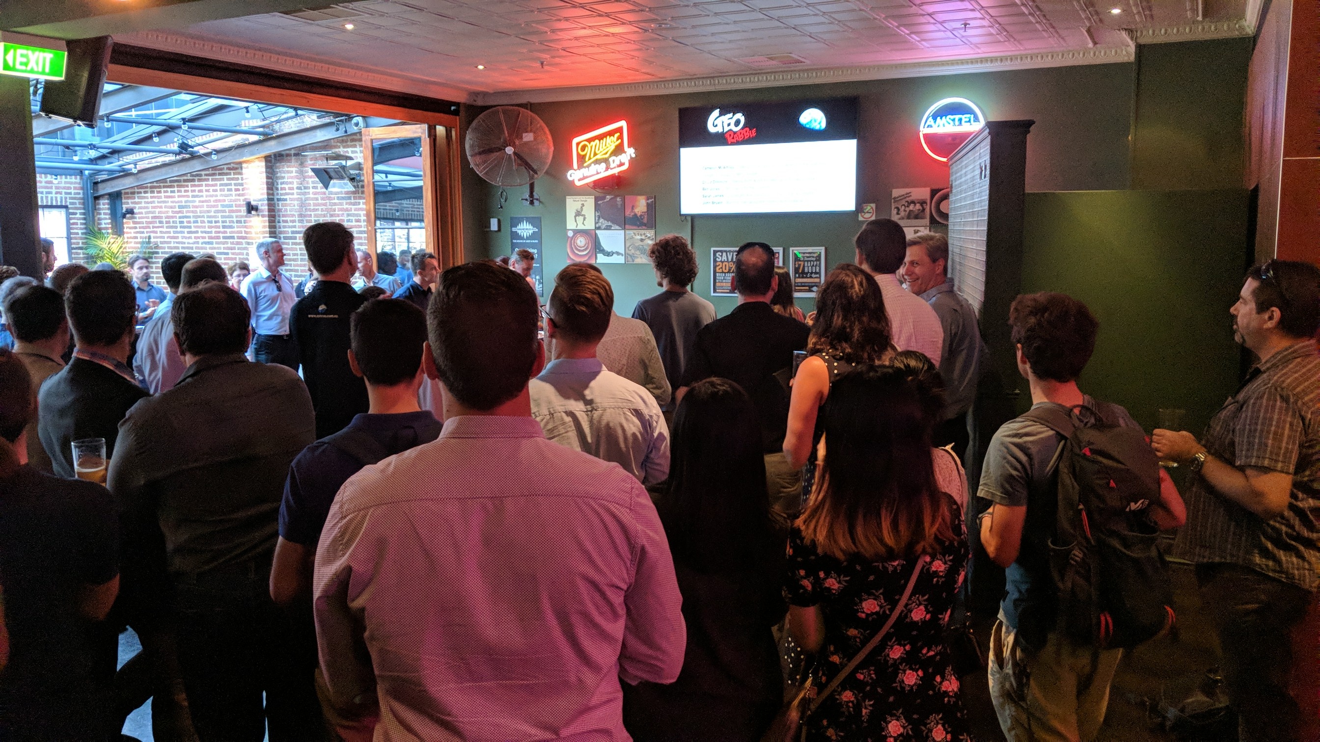
Come and hear their great talks next Thursday March 29 at the Shelbourne Hotel (doors open 5.30pm, talks from 6.30pm).

Get your free tickets at GeoRabbleSydney4.eventbrite.com.au

Woot! GeoRabble rolls into Brisbane

GeoRabble #1 arrives in Brisbane on Tuesday April 17 (doors open 5.30pm, talks from 6.30pm). Then grab yourself a free ticket!

Old Boys
GeoRabble Arrives in Brisbane! (Photo by Cyron Ray Macey)

Hungry for a tasty serve of Brisbane geospatial goodness, free of agendas and sales pitches, amongst your friends and colleagues?  Want to find out about some of the great unsung work being done by passionate people working with location? We’re lining up some great speakers and topics and there are a few speaking slots available – if you’ve got something new and exciting from the world of geo, please email us at brisbane@georabble.org