We’re excited to kick off 2017 with a brand new spectacular GeoRabble!
Join us in the ‘rabblin fray to ponder, muse & debate all things spatial (and maybe even meander into the not-so-spatial!). Leading us to the fringes of the spatial spectacular, we are excited to announce the following line-up of titillating talks:
Speakers:
Dhan Prabu – Maps with a Twist
Suzanne Brown – Drainage and Liveable Communities
More to be announced soon!
Date: Wednesday 22nd February 2017 Time: Doors open 5:30pm, Presentations from 6:00 pm Location: Universal Bar, 221 William St, Northbridge Format: A handful speakers, 10 minutes each, a room full of ‘rabblers, and the usual rules Registration: Attendance is free, but for catering purposes we need you to register!
We can’t hold these events without the help of the greater Geocommunity! Please contact us if you’d like to be a part of sponsoring a future event or get involved in helping organise an event.
We would like to extend a warm & merry invite to join us for a very spatial end of year event in Perth, together with the geo-folks from Geogeeks & Geospatial Amateurs community groups.
No RSVP is required and the event is free to attend. Please feel free to forward, share or invite others who may be interested in coming along.
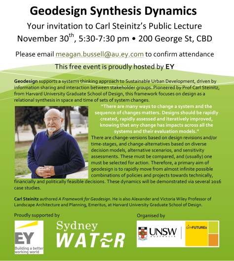
All are welcome to attend a public lecture on Geodesign by Carl Steinitz on November 30th, 5:30-7:30, at the EY Building (Level 34), 200 George St, Sydney CBD.
The Geodesign process supports a systems-thinking approach to Sustainable Urban Development decision-making. Supported by GIS applications and visualisation tools, it is driven by information sharing and interaction between stakeholder groups.
Geodesign workshops facilitate stakeholders’ recognition of existing and potential information gaps, as well as the social, environmental, and political complexities of a given study area.
Carl Steinitz is Wiley Professor of Landscape Architecture and Planning at Harvard Graduate School of Design. He will be sharing his insights and experience in pioneering the Geodesign process and holding workshops in different parts of the world.
Click here to view the event page and register, and here to view a previous lecture on Geodesign.
We’re pleased and excited to announce our final line up of speakers for the next georabble – women in georabble on 10 November!
If you haven’t already registered, please head to eventbrite or meetup to let us know you’re coming!
Although we’re only having women take the stage, obviously all are welcome to attend for an awesome night of great talks, networking, free nibbles (courtesy of our sponsor – Jacobs) and beers!
Speakers
Alex Young (awe.media)
360 photos and videos are the web tiles of tomorrow
Claudia Nguyen (AAM group)
Urban Design – a Spatial Perspective. A collaborative effort to building Smart Neighbourhoods.
Starting us off for the night was Tracy Jin Cui, with a fast-moving slide deck (47 slides!) on spatial in China; and one thing was astonishingly clear -not only is the spatial industry growing – it’s booming; and is now worth about 42 billion (US) dollars. Demand for location products and services continues to grow at a fast pace, and predominantly the platform of demand/use is mobile.
Tracy Jin Cui on Spatial in China @ GeoRabble Perth #17
Bringing us back to more local extents, Marcia Schneider walked us through the ‘Historical Panoramas: Perth and Fremantle’ project which was borne out of a collaboration between Curtin University’s HIVE and the State Library of Western Australia. The project sourced historical images dating as far back as 1860, and stitched these into seamless panoramas. A sample set was then selected and georeferenced; and a task then set to capture modern-day panoramas of the same locations. Challenges faced included trying to access locations that were no longer accessible (but luckily drone technology was on hand). The resulting product was a beautiful virtual tour of the selected locations with the ability to fade/time-slide the panoramas. The tour can be accessed online here; and more locations are in the pipeline.
Historical Panorama Demo @ GeoRabble Perth #17
Next up, we had Voon Li Chung speaking to the keen georabblers about a possible method to optimise database queries involving GPS coordinates. The kernel of the issue is when performing a proximity search for coordinates stored as part of a larger database/dataset, there generally is no spatial relationship or index component to speed up the search. Either you go row-by-row or store all coordinates in memory…. Not particularly desirable when your computational device is a smartphone (and a cheap one at that). The aim was to devise a solution that could use the at-hand, off-the-shelf smartphone database technology (sqlite3), which already had desirable features – it’s fast, simple and taps into inherent database qualities – such as integer searches. The solution proposed would allow one to set a point of reference (of a certain distance from an interest point) and pre-calculate distances of other points from this reference point; and then perform search for those points falling within a certain (pre-calculated) distance range. This concept was further refined upon by introducing bearing values between a point and the reference point. These combined heuristics reduced a sample search set of coordinates from 133354 points to just 98 points! Impressive stuff!
Carrying on from Voon Li, we had Onno Benschop talking to us about his experiences participating in this year’s GovHack; and he walked us through his team’s hack on public housing in WA. They attempted to answer the ‘flipside’ of the more commonly known/asked question of ‘where should we not build public housing’ in order to address the ‘where should we build public housing?’ question. To do this, they tried to ascertain housing demand and accessibility to key services (in areas such as health & education) in order to rank areas by their desirability for public housing; and then produced visualisation of this in a geographical format – a map. Onno also spoke to us about experiences in the hackerspace environment and what it’s like to be a part of such an event. The link to their project page is here.
To conclude the evening, we had John Bryant speaking to us about a wonderful local initiative called ‘GeoGeeks’ which is an open-source based geospatial hack group that brings together an inspiring bunch of people fortnightly to tackle geospatial projects. John talked us through a couple of projects on the go: the ‘Maps for Lost Towns’, a venture aiming to bring 6000 historical map images to keen georeferencers through crowdsourcing technology; and the ‘WA Media Statements’ project which seeks to geocode all existing media statements to enable location-based searching/viewing. And many more projects are on the books – such as spatially tracking food trucks through tweets, or solar panel crowdsourcing. John also touched on the reasons to become involved as geospatial professional, regardless of your level of experience. You can learn new geo skills and improve problem solving abilities; it’s also an opportunity to give yourself the time/space to actually work on your own ideas, network and build meaningful connections with other industry professionals. And, because people from all industry-walks of life are welcome, you might even have the opportunity to open your mind to new ways of tackling age-old geospatial problems. To find out more, head this way.
A huge thanks also to our sponsor – Survey Results. Cheers! We couldn’t run events like this without the generous support of organisations in our industry.
We’re also making a call-out for some new organisers to join the local Georabble team. If you have ideas for topics, even if that means dobbing someone else in, or can help us with some drinks and nibbles for next time, we’d love to hear from you via perth@georabble.org.
Stay tuned via #georabbleper for news about our next event coming up soon.
We are happy to announce our first speakers for GeoRabble Sydney, 7 July 2016 at the King Street Brewhouse– 22 The Promenade, Darling Harbour.
On the topic of finding your way, where traditional addressing may not be good enough we have:
Oliver Slezak (https://twitter.com/itruckbot) propositions Georabble that a “Front Door” is the reference point at any location. He proposes to invite all digital mappers to co-operate to map “Front Doors” as its reference point, starting with allowing volunteered input.
Brian Nicholls (AAM, https://twitter.com/nicholls_b) will present a “fully 3D enabled GIS based property booking system”.
We’re still taking speaker and panelist submissions, so if you would like to share an idea on this theme, get yourself out there and contribute to the rabble email us at sydney@georabble.org
If you just want to listen, enjoy the free food (courtesy of Pitney Bowes), and have a drink and a chat, please join us on the night!
As always, GeoRabble is a free event, but we need you to register for catering purposes. So please register here.
We are looking for panelists who can pitch their thoughts/ideas on the topic, and then participate in a panel discussion and brainstorming session with the Rabble. If you would like to participate in the panel, please contact us at sydney@georabble.org with your proposed topic.
With the advent of GPS phones, satnavs, and disruptive services such as Uber, Car Next Door or Foodora, we increasingly need to communicate locations to travel to, meet people, deliver parcels or be picked up or rescued from.
Whether you are in GIS, Logistics, Home Delivery, Event Management, Drone Delivery, or Mining, you are likely to find that traditional addressing does not provide enough detail, leading to cold Pizzas being delivered, not finding your friends at the festival, missing Uber pick-ups, and truck drivers doing laps around a business park looking for the loading dock.
Can more exact locations be crowd-sourced? Or automatically recognised? And who will collect and share these? What is the role that a Google, Here, TomTom, MapCode or what3words can play?
Save the date: July 7th to join the GeoRabble and learn more, discuss ideas, and have a bite and a drink with like-minded people.
The final list of speakers for the next Sydney GeoRabble, our special 5th Anniversary event and we have a great line up from all parts of the broad geo community;
Michael Ridger representing the Engineers Without Borders community talking about the – Crowd Sourcing GeoData for Public Engagement in development event
Andrew Harvey from Alantgeo presenting an intriguing talk called – One map to rule them all – hopefully Sauron isn’t in the audience
Rob Tyson and Jonathan Cairns-Terry from PwC talking on Geospatial Economic Modelling
Luke Bacon from the Open Australia Foundation presenting – Fixing bugs in our democracy
Hugh “No GNAF Royalties on me” Saalmans presenting on Intro to Open GNAF
Iurii Shendryk from UNSW talking on 3D mapping of forest resources from the air
Get your tickets at Eventbrite and remember we are at a new venue the King Street Brewhouse – 22 The Promenade, Sydney, – View Map