Tag Archives: Speakers

GeoRabble Tas #3 – Post-Event Writeup

The third GeoRabble Tas event was held on Thursday the 25th of September and we had a record 61 people register to attend. The event was held upstairs at The Republic Bar in Hobart and was sponsored by Lester Franks (thanks again, LF).

Presenters were excellent as usual. Presenters and presentations were as follows:

  • Arko Lucieer spoke about the efforts of Terra Luma, which is a group organised out of UTAS that are researching unmanned aircraft system  (UAS) applications. He spoke about the difference between airborne LiDAR, structure from motion and their work comparing the two techniques, as well as a number of specific applications of UAS as a data capture platform.
  • Adrian Fairfield, from Cohen and Associates, then spoke about projects that their platform had been working on, including capturing ortho-imagery across coastlines and other inhospitable areas.
  • James Head-Mears showed us all the fancy close range point-cloud creation tools that Lester Franks use in order to capture a variety of data for a variety of applications, and he showed us the process of reverse engineering an army truck.
  • Finally, Simon Allen wowed us with a great talk on getting results, with his SWAMP, or Shallow Water Autonomous Mapping Platform. The SWAMP is a robot boat, created with a few thousand dollars worth of off-the-shelf hardware, which was used to collect ground-truth or training data for a cloud-based machine learning algorithm, which then estimates the depth of the entire Derwent Estuary! (I think that’s it in a nutshell…) His more important point was that often a lot of time is spent developing the perfect solution to a problem, while it is often just fine to build an imperfect solution that might just work even better. It fits well into my little philosophy of ‘perfection is the enemy of the good.’

In summation, a lot of interest was piqued, some delicious food consumed and lots of catch-up occurred. It will happen again, soon, and so I’ll see you there at the next GeoRabble Tas.

– Alex


Arko Lucieer presenting about UAS
What a handsome audience!

GeoRabble Auckland: Final Speakers Announced!

Registrations are now open for the inaugural Auckland GeoRabble, Thursday 25 September! Attendance is free, but for catering purposes we need you to register. Register here.

The presenters are:

  • Geoff Leyland, Incremental, Route Planning on Open Data. Alex will be talking about custom solutions for better decision making using tools like mathematical and economic modeling, optimization and simulation and open data.
  • Alex Raichev, Affordability in New Zealand – making the website. Visit the website at http://affordability.org.nz/
  • Linda Bulk, Aeronavics – Advanced Aerial Solutions, Multirotor airframes & Ready to Fly – Industrial platforms – Tools not toys. Linda will be talking about how they Aeronavics Ltd is a manufacturer of advanced multi-rotor airframes, RTF craft and related accessoriesthe expanding market in aerial robotic systems for aerial photography, filmmaking, professional cinematography and the service sector.
  • Hamish Campbell, Koordinates, Licensing, Geodata and You – a brief look at the the open geodata licensing landscape. Hamish will be taking about licensing and legal issues with open data and releasing data into the wild.
  • Malcolm Archbold, Beca, Creating 3D models using your camera. With the advances in digital imagery pixel correlation anyone can now create high resolution 3D digital models using a hand held camera.


There is all the usual stuff, free food (courtesy of Glenn Stone Insurance), beer and other drinks, not so free. Join us for great conversions, networking and learn about interesting stuff. See you there!

Date: Thursday 25th September, 2014

Location: Horse and Trap Pub, 3 Enfield St, Mt Eden.

Time: Staring at 5:30pm, Presentations from 6 pm, finished around 7:30 pm

Format: A handful speakers, 10 mins each plus questions

Registration: https://www.eventbrite.com.au/e/inaugural-georabble-auckland-tickets-13016754463

Many thanks to Glenn Stone Insurance for sponsoring

Any questions or queries to auckland@georabble.org

GeoRabble Auckland – Save the Date (25th September) & First Speakers Announced

GeoRabble is finally crossing The Ditch, and is coming to Auckland Thursday 25th September at the Horse & Trap, Mt Eden.

Networking drinks 5:30pm. Presentations commence: 6:00pm followed by more networking.

Come along for an evening of Geo talks, networking, (free) food and drinks. Food courtesy of Glenn Stone Insurance (NZIS Diamond Partner)

Our confirmed speakers are:

  • Geoff Leyland, Incremental, Route Planning on Open Data
  • Alex Raichev, Affordability in New Zealand – making the website
  • Linda Bulk, Aeronavics, Multirotor airframes & Ready to Fly – Industrial platforms – Tools not toys

More speakers will be announced soon, and we’re always looking for exciting, engaging or just plain interesting talks on anything geo-related.

Food courtesy of Glenn Stone insurance

Do you have an interesting start-up, idea, experience or ‘war story’ you’d like to share in 5-10 minutes? Then send us an email (Auckland@georabble.org), with a title, a short description, and why you think we should pick your talk!

Register for this event here.  

See you there!

GeoRabble Tas #3 Announcement

GeoRabble Tas #3 is on!

We’re doing a point cloud special and have some great speakers from across Tasmania talking about what they’re doing with big masses of data.

Presenters include:

  • Adrian Fairfield, from Cohen and Associates, talking about UAV results – rubbish in rubbish out! but what’s possible if you don’t start with rubbish? a look at some interesting agricultural, environmental and construction examples.
  • James Head-Mears, from Lester Franks, talking about recent work in laser scanning and structure from motion
  • Arko Lucieer, from UTAS, talking about the TerraLuma research project at the University of Tasmania. Arko will give an update on the most recent developments in hyperspectral scanning, LiDAR, and 3D point cloud generating with UAS.
  • Rob Musk, from Forestry Tasmania, talking about some tales from Forestry Tasmania’s foray into estate surveying using small footprint airborne laser scanning

There is all the usual stuff, free food (courtesy of Lester Franks), craft beer (or regular beer), not so free. Good folks, conversation, inspiration and all that, so see you there!

Date: 25th September, 2014

Time: Doors open 5 pm, Presentations from 5:40 pm, finished around 7 pm

Location: Republic Bar, North Hobart

Format: A handful speakers, 10 mins each, usual rules

Registration: Attendance is free, but for catering purposes we need you to register.

Thanks heaps to Lester Franks for sponsoring.

Eventbrite - GeoRabble Tas #3


Lester Franks Logo

GeoRabble Sydney Wrap-Up

Last Thursday July 17th, a large crowd of Geo-enthusiasts gathered at the Occidental Hotel in Sydney for a long overdue evening of GeoRabble, Beer & Pizza (thanks to Hexagon Geospatial).

We had a great, eclectic and diverse line-up of speakers, under the capable and entertaining management of MC for the night Francisco Urbina.

GeoRabble Sydney crowd (photo: Maurits van der Vlugt)

Continue reading GeoRabble Sydney Wrap-Up

GeoRabble Perth #10 Wrap

GeoRabble #10 – It’s a wrap!

Happy 10th Birthday to GeoRabble Perth!

The evening kicked off with mirth to the sounds of a downpour or two as wet GeoRabblers braved the weather and trundled into the warmth and a welcome drink to celebrate all that is geo goodness.

GeoRabblePer10
Captivated ‘rabblers at GeoRabble #10 in Perth
MC Nic Flett for GeoRabble #10 Perth


Continue reading GeoRabble Perth #10 Wrap

GeoRabble Sydney- July 17 – Additional Speakers announced!

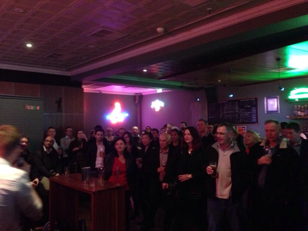
GeoRabble is coming back to Sydney: Thursday 17 July at the Occidental Hotel in Wynyard.

Get ready for an evening of Geo talks, networking, (free) pizza and drinks.

Pizza courtesy of   Hexagon Geospatial Hexagon Geospatial

We are proud to announce additional speakers:

1. Charles Connell / Colin Goudie (Social Pinpoint):  Twitter  LinkedIn

Combining GIS and online mapping for effective community engagement tools


2. Andrew Goodwin  (Umwelt):     LinkedIn

Processing and Managing LiDAR:  LiDAR data can be utilized in environmental in the environmental consulting work, as well as wider applications.  This has included developing finite element meshes and building outlines from LiDAR for flood and noise modelling and numerous ecological applications such as detecting malleefowl mounds across expansive remote areas.    We have developed our own automated swathe alignment system and LiDAR classification system that form part of the Anditi processing suite.  We have also developed techniques to delineate infrastructure (powerlines, roads, bridges etc) using LiDAR.   We have designed using a plug in architecture and  a graphical interface that allows us to check data and outputs from analysis.  This enables us to develop and implement new solutions to spatial data challenges rapidly.


3. Andrew Harvey   websiteavatar250

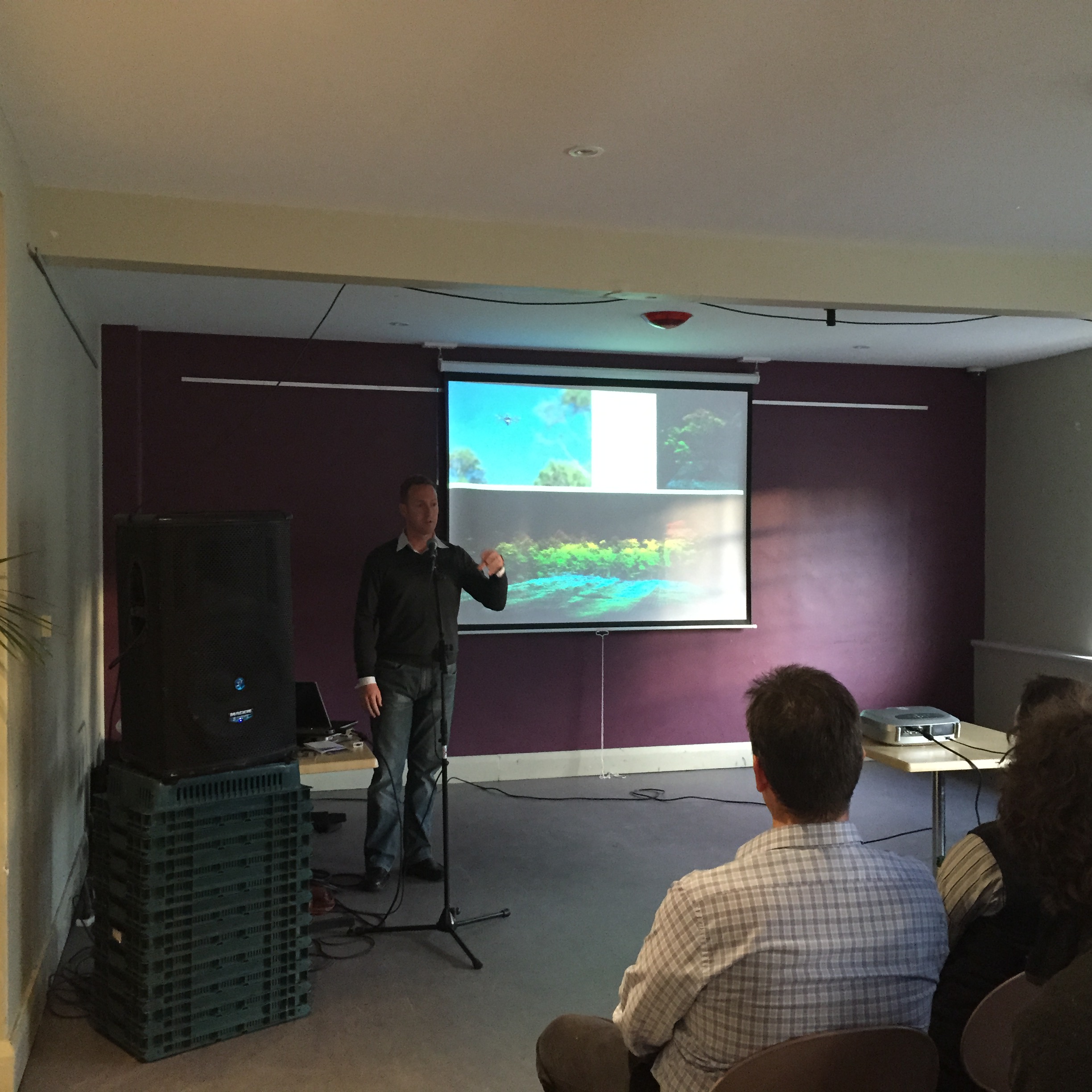
Landsat 8:    Using Landsat 8 data to extract information, and to extend this further, for example what Mapbox did for their Cloudless Atlas.


4. David Whitfield (Geepers):   LinkedIn

The evolution of in-building mapping and navigation

  • “Can the Internet of Everything really happen without a central GNS (Geo-physical Naming System), and
  • “Seamless navigation from the external world to the built environment – the evolution of in-building mapping and navigation”


5. Amelia Loye (Engage2)     Twitter  Linked In    amelia

EngageTech and GIS data: engagement and interoperability:   Amelia will speak to the technologies being used for engagement and how and why     interoperability with    GIS software is increasingly being required. She’ll speak to both map-based engagement methods and the use of geolocation data to engage, identify and manage relationships and information collected from citizens and stakeholders.


6. Maurits van der Vlugt (Mercury Project Solutions):   Twitter  LinkedIn   download

Gerrymandering and the US government Shutdown:  Some analysts blame last year’s US political stalemate and subsequent government shutdown on the practice of ‘gerrymandering’: redrawing voting districts to manipulate election results. This talk will explain the history and concepts of the practice of gerrymandering, how it leads to polarisation and subsequent political stalemate.

Do you have an interesting start-up, idea, experience or ‘war story’ you’d like to share in 5-10 minutes? Then send us an email (Sydney@georabble.org), with a title, a short description, and why you think we should pick your talk!

Register for this  here, or join the Meetup group.

See you there!!!

Announcing GeoRabble Perth 10!

Happy Birthday to Us, Perth is now 10 georabble’s old.  For our 10th Rabble, we want a rabble of epic proportions!

Speakers:
  • Ross Currie
  • Paul Lucey
  • Rob Freeth
  • Kellie Ireland
  • plus more to be announced soon!

Date: 26th June, 2014

Time: Doors open 5:30pm, Presentations from 6:00 pm
Location: Universal Bar, William St, Northbridge

Format: A handful speakers, 10 mins each, usual rules.

Registration: Attendance is free, but for catering purposes we need you to register here!

Huge thanks to our Sponsors at the Department of Planning

planning_logo_gray

GeoRabble Perth #9 Review

Over the four long, hot months since the WALIS forum in November, Perth geo-geeks built up a Rabble-sized thirst, with only one way to quench it… cue GeoRabble Perth #9! Held at the Universal Bar in Northbridge, this iteration of Perth’s favourite geo-outing drew a big crowd, including some of the usual suspects and many new faces.

As usual, we had a great array of thought provoking speakers bringing their perspective on what makes our field of endeavour fascinating. It’s not easy to stand up in front of your peers and talk about yourself for 10 minutes, particularly given GeoRabble’s strict rules on sales pitches, ‘about us’ slides, etc… but these folks really delivered the goods.

Ably hosted by Chelsea Samuel, GR#9 was kicked off by Grahame Bowland, who dazzled us with some pretty serious SQL queries, but promised that his open source geodata analysis framework would save us from having to write them ourselves.

Emil Vulin was up next, and shared his perspective on the exciting area of mobile mapping, including some interesting observations on the arrival of low-cost tablets in the developing world.

Sophie Richards’ talk on her experiences in crisis mapping with the UN, and particularly the use of crowdsourced information, was a fascinating look into how mapping and spatial data can make a real impact in the lives of people.

For something completely different, Chris Toovey treated us with some eye candy, talking about his experiences in the business of making 3d animated scenes, as said scenes flashed by on the screen. Cool!

Finally, Dan Goldberg, visiting from the University of Texas, dropped in to tell a few jokes and talk up his students.

And with the presentation portion of the evening at its end, the GeoRabble settled in for beers & some spirited conversation.

Thanks to all our speakers for entertaining us and providing food for thought, and to everyone who came and made GeoRabble #9 a great night! We’ll look forward to seeing you at the next one, and if you have a geo-story to tell, we want to hear from you…  Also thanks to our sponsors Talis Consultants

GeoRabble Tas #2 – Post-Event Wrapup

GeoRabble Tas #2 was a another success. Feedback received after the event was very positive: great food, great presenters and a great venue (thanks, Republic Bar).

On the presenters, it was a diverse bunch of folks. The evening started with Peter Boyer, who writes about climate change from a Tasmanian perspective. Peter gave us an excerpt from the latest IPCC report, which was a timely reminder that this issue is not going away and that we need to continue planning for it.

Next Steven Harvey and Ryan Anthony spoke about transforming a map drawn in 1826 into a modern interactive web-map. They spent last summer digitising the Sharland map, including information and images relating to buildings and property owners that were present on the old map.

Rob Rowell, from Insight GIS, then got us all excited about visualisation with a presentation entitled ‘If Visualising Information is Beautiful – is GIS the Ugly Sister?’ which contained many examples of beautiful non-maps, spatial information presented in innovative ways.

Buy my highlight of the evening was John Corbett and his ‘virtual sandpit’, which is difficult to give justice to in words. Here’s what it does:

  • It’s got a Kinect sensor and a projector, both pointed at a 1 m x 2 m area of terrain (composed of bean bags and tubes with a white sheet over it all)
  • An attached laptop models the surface in real time and projects snow-capped mountain peaks in the high bits and leafy green forests that grow over the low bits
  • Then there’s a water source , which is powered by an ‘industrial strength fluid model’, and which creates streams and lakes all while reacting to changes to the landscape and your hands
  • There’s a little toy Humvee, which you can drive through the landscape splashing through the water and leaving tire tracks behind it
  • For the grand finale, if you push the top of the mountain in, a vol lava flows out the top of the newly created volcano!

We have photos, but really you had to be there…

-Alex

Terrain in the Virtual Sandbox
Terrain and truck in the Virtual Sandbox
Terrain, water, lava and chaos in the Virtual Sandbox