We have a great line up for our next Sydney GeoRabble, with another burst of interesting talks about all aspects of geo, guaranteed to be free of sales pitches. Confirmed speakers are:
Llew Cain – Are we 2D living in a 6D future?
Jody Garnett – Business intelligence and mapping
Mark Warton – Mobile apps for the Easter Show
Matthew Smith – About the Fires Near Me mobile app
Stephen Lead – Esri’s 100-lines-or-less competition
Chris Broadfoot – What’s new in the Google Maps API
Date: Thursday 11th April Time: 5.30 pm for 6.00 pm start Location: Occidental Hotel, 43 York St Grab your tickets from georabblesydney6.eventbrite.com – as always it’s free, with no membership fees.
When not sailing himself, or maintaining a web map devoted to the Brisbane to Gladstone Yacht Race, Ben Somerville is well known to ArcGIS users as an early adopter and advocate of Esri’s developer and server technologies.
As Spatial Systems Manager at Thiess, Ben is responsible for the management of a GIS that supports many projects across multiple disciplines and platforms. Ben currently spends most of his time supporting the Silcar Thiess Services joint venture which is designing and constructing the NBN in Qld, NSW and the ACT.
For GeoRabble Brisbane #3 Ben is planning to share his thoughts on managing large field work forces and the impact the NBN could have on the GIS industry.
A Return to Yesteryear – Thunder and Lightning and Storms, Oh My!
14th March 2013, Leederville Hotel
The evening kicked off to the tune of a slightly tempestuous weather machination and some sixty-odd slightly damp GeoRabblers bunked down to listen, drinks in hand, as the yarns of geospatial speakers unravelled to the sound of rain against the Leedy’s tin roof.
Or something akin to that!
The master of ceremonies Damian Shepherd led the keen GeoRabblers through the dark and stormy night, and kicked off the presentations by introducing Mike Bradford, CEO of Landgate. Onwards on a journey through time and space, Mike explored the evolutionary steps of spatial technology and glimpsed at the possibilities and trends for the future of the industry. From quasi prehistoric GPS receivers approaching the size of the MARS Curiosity Rover, to preparing for the influence of a predicted 1200 satellites going up in the next 10 years, the emphasis was on the fact that the future of GIS is coming at us harder and faster than ever before – and adaptation is the key to surviving and thriving in this (r)evolutionary world of all things spatial.
Next up, Roman Trubka and Cole from Curtin University flew us through some 3D urban planning scenario models, illustrating the inherent potential of spatial tools to explore, analyse and communicate the viability of development proposals and plans. Emphasis was on the intrinsic spatial nature of planning and how spatial tools of today can better inform and progress location-appropriate development.
Leading us into the fray of what it means to be a professional in the geospatial industry, Jen Hogan of Spatial Solutions started with the question that bubbles up at so many a social gathering and yet so frequently stumps many a geospatial professional: “So, what do you do?”. Between the blank look you get on saying something like ‘GIS’ to mumbling the ‘yes, something like Google Maps’ answer, the truth more often than not gets stuck in translation. Cue ‘Captain GIS’ to the rescue! Jen encouraged us speak out about all the things we love about spatial and not to hide away behind answers that make the awkward question go away. And, that when it comes down to it, emphasise that what we do is solve problems in a way that no one else can.
Tom Gardiner from ESRI took to the stage from there and further searched, queried and unravelled the meaning of what geospatial means in the context of world today. Leading us through an analysis done by high-school students at Hale School on finding the best location(s) for a sustainable community in Western Australia (as part of Spatial Technology in Schools Competition), on to consuming BoM data of cyclonic pathways in the context of the student’s analysis, Tom highlighted the ever expanding kaleidoscopic nature of spatial questions, data, technology and analytical approaches that sit at our fingertips.
With the tantalizing smell of hot pizza starting to waft through the air, the last speaker of the evening Charlie Gunningham from REIWA took to the stage and enraptured GeoRabblers with a tale of success, entrepreneurship and geospatial history. From mad Saturday morning rushes navigating the cityscape streets with nothing more than a street map-book and a handwritten trajectory in hand, was born the idea of placing real-estate sale advertisements onto an online map. It was an idea that then set the stage for real-estate websites across the world today. For some GeoRabblers the tale was a fond trip down memory lane, for others a unique chance to hear the history first-hand of the technology that is standard of the day. (Charlie reviews his first GeoRabble here)
The #democracysausage dataset made it into a GeoRabble side. Data collected on Twitter 9 March, 2013. Image/Data courtesy of @bogurk, @davecorgillous and @kevin_rudds_cat
And onwards into the stormy night did the GeoRabblers talk, eat and enjoy many a conversation.
Many thanks to the speakers of the night, to WaterCorp for supplying the projector and to the sponsors SSSI WA Region.
GeoRabble happens in various locations around Australia, is free and open to anyone, but frequently sells out. If you would like to talk at a future Perth GeoRabble event, please send an email with the title and a short description to perth@georabble.org.
Our streets and cities are being transformed into fictional worlds, through the imagination and tools of mobile game designers. They see your surroundings as the new arena for play, and your pocket device as the new interface for adventure. This presentation will show some of the latest innovations in location-aware games, and how you can participate in this emerging practice as both a player and a developer.
Deb Polson is a lecturer in Communication Design at Qld University of Technology. She is also the Director of Newish Media, and an independent game designer.
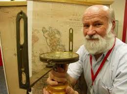
GeoRabble Brisbane is honoured to welcome Bill Kitson to our spatial gathering!
Bill Kitson is one of Queensland’s best known surveyors and a highly respected spatial historian.
Following a 1974 Survey Office investigation of the surviving markers along the Queensland State borders, Bill became ‘hooked on history’ researching the lives and work of the men that mapped Queensland. This interest in heritage became his vocation in 1980 when he was appointed as curator of the then newly established Lands, Mapping and Surveying Museum.
Even in retirement Bill continues to be a prolific and highly effective communicator. His passion for preserving surveying heritage and his generosity in sharing his unsurpassed knowledge of the spatial industry have become legendary.
His talk will be titled ‘Surveying Heritage, Our Glorious Past’.
“Imagine if the whole human race had been looking through one eye for all of our existence and, all of a sudden, scientists gave us the ability to open up a second eye. You’re not just getting more information, more data; you’re literally getting a whole new dimension. You’re getting depth and perspective, 3D vision. That’s what Big Data is, not simply more information but a new way to see or extract meaning from a sea of information. Simply put, Big Data is giving us a brand new way to see things.”
Coinciding with Big Data Week we’ve arranged a line up of speakers like never before. Big Data Week is one of the most unique global platforms of interconnected community events focusing on the social, political, technological and commercial impacts of Big Data. It brings together a global community of data scientists, data technologies, data visualisers and data businesses spanning six major commercial, financial, social and technological sectors.
Speakers:
Gary Casham – Microsoft
Ian McCleod – WA Museum
Tim Heighfield – Researcher
Kevin Vinsen – SKA Project
Bryan Boruff – UWA
Paul Farrell – NGIS
Date: 23 April, 2013 Time: Doors open 5:30pm, Presentations from 6:00 pm Location:
Rubix Bar & Cafe
334 Murray Street
Perth
Format: A handful speakers, 10 mins each, usual rules.
Registration: Attendance is free, but for catering purposes we need you to register!
We can’t hold these events without the help of the greater Geocommunity, so if you want to get involved let us know! This event brought to you by the Perth GeoRabble team and Landgate
We sometimes like to surprise on the night but we already have two fine co-sponsors for GeoRabble Brisbane #3 on Tuesday 23rd April – namely GIS Recruitment and AAM – and six people who have offered to present at this GeoRabble or next!
The speakers, subject to final negotiations on topic and beer, and in no particular order, are:
Bill Kitson
Deb Polson
Ben Somerville
Andy Stewart
Andrew Saad
Phil Punter
More details to come on their talk titles but Location Based Games is among them.
If you’ve not signed up yet follow this link to score one of the remaining FREE tickets.
GeoRabble 5 – We hope there aren’t any pitchforks or burning torches
Exciting news! The Perth GeoRabble crew are busy preparing to host two GeoRabble events in the next two months. “WHAT?? They’re Crazy!” I hear you exclaim…. Challenge Accepted.
The first GeoRabble for 2013 kicks off on the 14th of March and the second is organised to coincide with Big Data Week (www.bigdataweek.com) on the 23rd of April. The formats for these GeoRabble events takes us back to a more traditional base with interesting speakers talking about what they find passionate in the Geo / Data world.
Announcing GeoRabble Perth #5 – Return to Yesteryear –
Thursday, March 14, 2013
Venue: Upstairs at the Leederville Hotel Time: Door @ 5:30pm for a 6:00pm start of presentations
Speakers:
Mike Bradford
Tom Gardner
Charlie Gunningham
Jen Hogan
Someone from the Curtin University’s Sustainable Policy Unit
We’ve been holding back some excellent speakers from previous rabbles, as we’ve had a sojourn through a Panel, and an Open Mic night, but GeoRabble #5 is returning to the Rabble Roots of yesteryear. A handful speakers, 10 mins each, usual rules. If you’d like to speak (or sponsor at future events), and you’ll be in Perth for that evening, please contact perth@georabble.org or one of the organisers (See the Perth contact page) and we’d love to hear from you.
“What Geo-Gift I want Santa to bring me this year”
Join us for GeoRabble Christmas Drinks on Thursday 6 December, at the Occidental Hotel in Sydney. (5:30 for a 6PM start, please RSVP so we can plan catering)
Co-hosts for the evening are the NSW Government 2.0 Community of Practice, and with them, we are proud to introduce our first ever international speaker Julian Carver from New Zealand, who will talk on: “A City to Rebuild – how spatial data sharing is supporting the Canterbury Earthquake Recovery”.
Julian is one of New Zealand’s most respected OpenGov and Opendata specialists. In 2011, Julian worked with the Data and Information Reuse Secretariat to design the Open and Transparent Government Declaration. He is a spokesperson to government for Open NZ (an organisation representing the open data community) and has chaired conferences including Open Government (June 2010), Smart Government (March 2011), and Web Oriented Government (October 2011).
From April 2011 – June 2012 Julian led the establishment of information services at the Canterbury Earthquake Recovery Authority (CERA), as acting Chief Information Officer. He then went on to lead GIS, data, and digital communications for the Christchurch Central Development Unit, for the launch of the Christchurch Central Recovery Plan.
Other than Julian’s, there will be no formal presentations this time. Instead we will have an open mike, and invite Rabblers to talk for 2 minutes about what Geo-Gift they’d like Santa to bring them this year. Other than that, it will be the usual mix of celebrating all things geo, networking and having a good time!
And in another GeoRabble first, we have a parallel event run the same evening by our friends from GeoRabble Perth
As usual, this is a free event, including free pizza (courtesy of OMNILINK). Places are limited, so do register here, or join our MeetUp Group to avoid missing out!
We are proud to announce the first speakers for the next GeoRabble event in Melbourne on Wed 12 September,in the Lanai Function room at CQ Melbourne. Doors open 5:30pm talks from 6:30pm.
Bill Cartwright – “NEOCartography: Prospects and Issues”. Bill takes a look at what is NeoCartography and what are the opportunities, issues and challenges for the cartography and geoscience community.
Yvonne Thompson – “Spatio Retro”. One of the original founders of GeoRabble Melbourne and self professed old lady of spatial in Australia, Yvonne takes an introspective look about how she originally found her passion for spatial.
Charlie Hawkins – “Flood Modelling a failure at Geheyan dam in China”. Flooding has been a very topical event in Australia but were you ever curious to know how a place like China would compare?
Monica Stephens – “Guns, Germans and Stripclubs the Fates of OpenStreetMap with No Respect to Jared Diamond“. A humorous and eye opening look at the who decides the feature types in OpenStreetMap and the need to focus on the gender gap in our industry.
We still have room for 1-2 more speakers so let us know if you have a geo-story that you would like share with everyone at the next GeoRabble!!


 2012 Julian led the establishment of information services at the Canterbury Earthquake Recovery Authority (CERA), as acting Chief Information Officer. He then went on to lead GIS, data, and digital communications for the Christchurch Central Development Unit, for the launch of the Christchurch Central Recovery Plan.
