All posts by GeoRabble

GeoRabble Tas #1 – Post Event Writeup

The first GeoRabble Tas was held on Thursday the 14th of November and attracted almost 40 registrations. The event was held at Tattersalls in Hobart in their upstairs room, which was probably a little small for the number of people. But the food was great, and free, thanks to the event’s sponsor, Geometry. Thanks Geometry! The speakers were excellent, and the crowd’s vibe very positive.


Continue reading GeoRabble Tas #1 – Post Event Writeup

GeoRabble Tas #1 – State of the Web Map

The first GeoRabble Tas is on and it’s going to be a web-mapping special. We’ve got speakers covering many aspects of the web, from Open Layers to Open Source, from big, complex statewide basemaps to foundational open data initiatives in local government.

We’ve got four speakers, a great sponsor, a tidy venue, good food… All we need is you to come along and make the event great! Book in here: georabbletas1.eventbrite.com.au. If you have an idea of a good speaker or topic, or if you’re interested in helping run an event in the future, drop by the Google+ Community.

Details:

When: from 5 – 7pm on 14th Nov, 2013

Where: Upstairs at the Tattersalls Hotel

Who:

  • Mark Chiltott – DPIPWE

  • Andrew Betlehem – Geometry

  • Alex Crothers – Launceston City Council

  • Peter Corlett – ESRI Australia

What: Four short talks followed by a panel session of question and answer.

How much: Geometry are sponsoring, so there’s free food and free entry.

Continue reading GeoRabble Tas #1 – State of the Web Map

GeoRabble Perth #8 – Dates, Speakers…. Tickets!

7th November 2013, doors open at 5:30pm

The next highly anticipated edition of GeoRabble hits Perth on the 7th of November 2013, coinciding with the WALIS Forum, Australia’s largest spatial conference! GeoRabble #8 will be the highlight networking event on the Thursday evening of WALIS Forum to be held at the Crown Convention Centre at Burswood.

Speakers:

  • Lise Summers
  • Erik Champion
  • Maurits van der Vlugt
  • Darren Mottolini
  • Brett Madsen
  • Helen Ensikat

If you’ve not attended a GeoRabble before, it’s a fantastic casual night, filled with short, pithy presentations from like-minded geo-types that are free from sales pitches.  We have released a whole lot more tickets to this event but don’t let that fool you with GeoRabble constantly being oversubscribed, get your ticket fast!

To secure your ticket to GeoRabble #8 visit: http://georabble-per8.eventbrite.com.au/

We’re pleased that SIBA (Spatial Industries Business Association) have come on board to sponsor the next Perth GeoRabble, and the WALIS Forum have agreed to host this rowdy mob. Our thanks to them, we promise they wont regret it. 🙂

Hope to see you there!

Perth GeoRabble

Follow @georabble on twitter or use the hashtag #georabbleper to join the conversation

GeoRabble Perth #8 – Call for Speakers

We are looking for interesting, entertaining, passionate and downright geogeeky speakers. If you have something you want to share, and can do it in 10 minutes, then please let us know at perth@georabble.org!

Join us Thursday the 7th of November somewhere near the WALIS Forum. Doors open 5:30 PM for a 6PM start. Registrations will open soon!  Thanks to SIBA for already offering to sponsor.

GeoRabble Sydney #7 Speakers Announced

A diverse range of geo topics has been assembled for next Thursday’s Sydney GeoRabble from geo hacking to geo broadcasting to massive maps.

Register @ https://georabblesydney.eventbrite.com.au/ and get your fix of geo talks, beer and pizza

  1. Stories from the frontline of GovHack – Team Fusrodata
  2. Why a Spatial Professional is never on Holidays – Stewart Hay
  3. The story behind designing GIS for Broadcasting – Channel 7 Election Maps, Bill Martin
  4. It is not about the bike – using data to make better transport decisions – Rebecca Lehman
  5. Geographic Biases in Scholarly Production – Frederick Michna
  6. Creating User Friendly Massive Maps – Kelvin Nicholson

GeoRabble Melbourne #5 Speakers Announced

We are pleased to announce the following GeoRabblers who have volunteered their time to share their fantastic GeoStories at GeoRabble Melbourne #5.

If you haven’t registered yet to listen to these fantastic speakers and the opportunity to network with your fellow GeoRabblers then do so now at https://georabble-melb5.eventbrite.com.au/

Photo Scott Manley

Scott Manley – Making GIS Mobile

Scott will discuss some of the challenges around building a mobile GIS Apps. Some of the challenges he will share include; offline basemaps, offline overlays/features, performance and battery use.

Scott has been designing and building enterprise IT solutions for almost 20 years. With a recent focus on mobility, Scott is currently interested in the problem of creating usable and effective mobile geospatial solutions (spoiler, its not easy). Scott is a senior consultant with Geoplex.

Photo Nathan Quadros

Nathan Quadros – Working on your own sucks

Who likes working on their own? Not Nathan. Identifying problems involves talking to people… communicating. It is a great feeling to present a concept, obtain support from stakeholders and to produce results. Seeing the smile on people’s faces when they see outcomes, and the impact, makes a project worthwhile. I am demonstrating a collaborative project approach through examples of my work at the CRC for Spatial Information. This includes an eclectic mix  based on research communications, project work in the Pacific Islands and LiDAR quality assurance. It will end with a couple of ideas to stimulate discussion.

Nathan has spent his career focussing on problems. He has been heard saying, “If there were no problems why wouldn’t we just get robots?” From 2008 until 2011 Nathan was solving the Victorian Government’s problems, even setting up the keenly awaited Victorian Government’s office in Bangkok. More recently, Peter Woodgate (CEO, CRC for Spatial Information) came to him and said, “Can you solve my problems?” Naturally he was up for the challenge, and been at the CRCSI ever since

Stewart Hay Photo

Stewart Hay – Are your online maps really reaching everyone?

Online maps are increasingly being used for presenting extensive amounts of information to the public. But are online map accessible to everyone? Stewart will take a look at how online mapping solutions fail to consider people with accessibility difficulties, why this is important and what can be done about it.

Stewart is the Principal Consultant for OneSphere and likes to help organisations get the best out of their GIS investment. His experience encompasses a range of industries from Environmental Management and Utilities to Emergency Services and all tiers of Government. During his free time he helps organise the Melbourne and Sydney GeoRabbles.

Phot Craig Molyneux

Craig Molyneux – Data to Design

Much of the spatial data we use today is designed for a single purpose – for use in creating print maps, display in a web GIS or recording specific details of a feature. With the development of multi-scale tile-based maps and there use in mobile devices, oftentimes this data requires major editing or addition of feature classes to make it fit for purpose. This presentation will look at the way he has been designing data to create stunning cartography multi-scale tile sets for mobile devices and web systems.

Craig has over 27 years’ experience designing and producing high quality cartographic products for some of Australia’s major publishers, including Hema Maps, Australian Geographic, Hardie Grant and Universal Publishers. His recent work includes the Jacaranda Atlas 7th and 8th editions, as well as the Jacaranda World History Atlas, Spatial Vision’s Outdoor Recreation Guide series print maps and iOS apps. He is presently studying his Masters of Land Information at RMIT University

Photo Paul Cook

Paul Cook – Statistical geolocation of twitter users

The language we use on social media gives hints as to our location, even when we don’t explicitly state where we are. Paul will present ongoing research on a system for automatically predicting a Twitter user’s city-level location, which usually gives a prediction within 10 Km of the correct location.

Paul Cook is a McKenzie Postdoctoral Fellow in the Natural Language Processing Group in the Department of Computing and Information Systems at The University of Melbourne.
 

Matt Coller

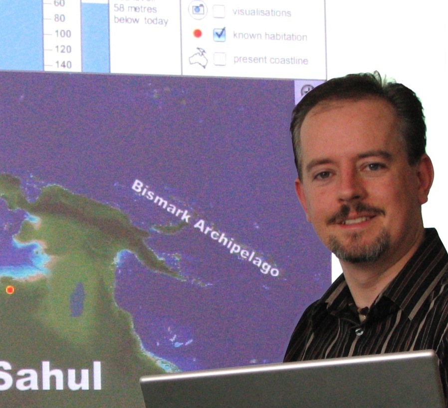
Matthew Coller – The Temporal Earth project: Visualising world history on all timescales

Temporal Earth is an investigative project to create a visualisation of world history across all timescales, based on similar principles to Google Earth.  This talk will include a series of proof-of-concept demonstrations covering topics in Australian history, archaeology, geology and palaeontology.

Matthew Coller is a PhD student in the School of Geography and Environmental Science at Monash University, currently completing his thesis in the hope of launching the Temporal Earth project worldwide next year.

GeoRabble is back again in Melbourne

GeoRabble returns to Melbourne on Tuesday 17th September at a new Venue (Coopers Inn – 282 Exhibition St Melbourne). Grab yourself a free ticket and enjoy the night with friends sharing geospatial ideas, free of sales pitches and hidden agendas!  Each presentation is light, relevant to geo-something and only 10minutes long.

You can register for the event at https://georabble-melb5.eventbrite.com.au/

We are calling for guest speakers – if you have a great geo-spatial idea that you would like to share with a group of like minded people, we want you! Contact the GeoRabble committee asap to express your interesting topic in 20 words or less, or email your idea to melbourne@georabble.org

A very special thanks to our GeoAwesome Spatial Vision Sponsor without whom we couldn’t run this event and provide food to everyone …

Spatial Vision Logo

Georabble Brisbane #4 is almost here

Don ‘t forget to put Tuesday the 27th of August into your calendar. GeoRabble Brisbane will be holding its next event at the Pig N Whistle, click the link to check out the fantastic line-up of speakers…

  • Peter Scarth – Open Source, Open Data, Mapping Beer?
  • Rob Bischof – Leveraging Your Worth
  • Stewart Hay –  Are your online maps really reaching everyone?
  • Phil Punter – There’s been an incident at Roma Street
  • Nathan Woodrow — Contributing to an open source project
  • Graeme BrowningStory Mapping for Family History

You still have to time to book your tickets and join in the GeoRabble.

GeoRabble Cape Town #1 Event Wrap

The first Cape Town GeoRabble event, sponsored by AAM Group, took place on Wednesday evening at the Mowbray Golf Club in Cape Town. Approximately 20 people from various industry spheres including government, academia, engineering, geo consulting, software development and internet start-ups attended the night.

The nights speakers in action.
The nights presenters in action.

We started at 18h00 with a short welcome and all round introductions, followed by the first presentation delivered by Chris Tanner, titled 3D Modelling. He provided the audience with an amazing bird’s eye view on the level of detail and accuracy that can be achieved in 3D models created by combining aerial photography and LiDAR data. This was followed by another 3D orientated topic titled, Low-cost 3D mapping of an urban environment using Structure from Motion , presented by Sebastien Wenger. Mike Steyn entertained the audience with a summarised view into the past, current and future development in GIS through a presentation topic titled; The Moore’s affect in GIS. This thought provoking presentation highlighted the rapid growth in technology in general and how the geo world is following this trend. The last formal presentation was delivered by Chlodwik Rossouw who asked the question, Is GIS a profession or a tool? He highlighted the different uses of geo tools, technologies & skills across a variety of industry sectors and how industry specific knowledge is affecting our industry. Both Mike and his topics urged people to keep an inclusive and not exclusive mind set and therefore stay aware of what is happening outside of their own geo realm and to keep moving with technological and industry advances.

The night was concluded with quite a few open discussions on how we can build on this first GeoRabble Cape Town event in order for it to appeal to the wider geo community.  This successful first night was concluded by more general discussions, networking, food and drink.

Thank you greatly for all who attended, plus AAM Group for sponsoring the event! … until next time.