The evening kicked off with mirth to the sounds of a downpour or two as wet GeoRabblers braved the weather and trundled into the warmth and a welcome drink to celebrate all that is geo goodness.
Captivated ‘rabblers at GeoRabble #10 in PerthMC Nic Flett for GeoRabble #10 Perth
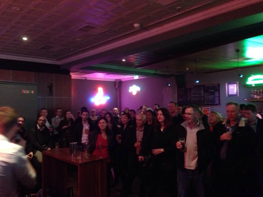
Over the four long, hot months since the WALIS forum in November, Perth geo-geeks built up a Rabble-sized thirst, with only one way to quench it… cue GeoRabble Perth #9! Held at the Universal Bar in Northbridge, this iteration of Perth’s favourite geo-outing drew a big crowd, including some of the usual suspects and many new faces.
As usual, we had a great array of thought provoking speakers bringing their perspective on what makes our field of endeavour fascinating. It’s not easy to stand up in front of your peers and talk about yourself for 10 minutes, particularly given GeoRabble’s strict rules on sales pitches, ‘about us’ slides, etc… but these folks really delivered the goods.
Ably hosted by Chelsea Samuel, GR#9 was kicked off by Grahame Bowland, who dazzled us with some pretty serious SQL queries, but promised that his open source geodata analysis framework would save us from having to write them ourselves.
Emil Vulin was up next, and shared his perspective on the exciting area of mobile mapping, including some interesting observations on the arrival of low-cost tablets in the developing world.
Sophie Richards’ talk on her experiences in crisis mapping with the UN, and particularly the use of crowdsourced information, was a fascinating look into how mapping and spatial data can make a real impact in the lives of people.
For something completely different, Chris Toovey treated us with some eye candy, talking about his experiences in the business of making 3d animated scenes, as said scenes flashed by on the screen. Cool!
Finally, Dan Goldberg, visiting from the University of Texas, dropped in to tell a few jokes and talk up his students.
And with the presentation portion of the evening at its end, the GeoRabble settled in for beers & some spirited conversation.
Thanks to all our speakers for entertaining us and providing food for thought, and to everyone who came and made GeoRabble #9 a great night! We’ll look forward to seeing you at the next one, and if you have a geo-story to tell, we want to hear from you… Also thanks to our sponsors Talis Consultants
Around 170 people were a part of Perth’s biggest rabbling ever, with MC John Bryant leading the evening. The event was held at Crown Burswood as a part of the WALIS Forum. Thanks to our sponsors SIBA (Spatial Industries Business Association) and WALIS Forum for having us there.
Brett Madsen was the first speaker, and it was a privilege to have a founding GeoRabble kick-starter from the East join us. His tale of where he has come from kept the audience captivated. Rules of GeoRabble may have almost been broken when services and business were hinted at –come on @DARKspatialLORD you should know better!
Darren gives Brett the slide clicker in return for a beer
Perth’s own GeoRabble committee member Darren Mottolini took over the microphone to let us in on distorting maps and how to get a message communicated through map distortions. Ending with zombie maps, what was not to enjoy in Darren’s talk?
A further founding GeoRabble kick-starter, Maurits van der Vlugt travelled a long way just to join Perth GeoRabblers for the evening (well, we would like to think it was just for us!). He delved into the fascinating topic of gerrymandering, and the influence that electoral boundaries have on election outcomes.
Lise Summers gave us a fascinating look into how maps are carefully taken out of archives, off the printed and hand drawn pages and captured into formats able to come alive on our computer screens. Lise’s description of her experiences with the digital capture process was an eye opener, to say the least. The amount of work and care taken to not destroy these precious pages in the capture process was remarkable.
Ever built a computer chair out of a car seat and a massage chair so that you can fully experience the bumps in the road in a game? Well, Erik Champion was involved in doing so. Making computer games come alive and really getting to experience the simulation world made for a fantastic talk.
Helen Ensikat has created Beaufort Street Maps capturing Beaufort Street in a stunning way. Various aspects of this street have been captured from Helen’s view point. From the coffee shop where she drank great coffee, to the stars, the food ratings of the restaurants, tagging on the walls, to the little black poodle which has a fluffy tail have been captured for all to see.
Please come along to the final gathering for 2013. This month we’ll be joining forces with the Perth GeoSpatial Network to celebrate the end of year with some casual drinks at Bob’s Bar (http://www.printhall.com.au/bobs-bar/ ). We look forward to seeing you there 🙂
When: Wednesday, 4th Dec, 5:30pm
Where: Bob’s Bar (Rooftop bar of the Print Hall)
If we don’t see you there, we hope you have a great festive season and we’ll see you in the new year – for GeoRabble #9!
The next highly anticipated edition of GeoRabble hits Perth on the 7th of November 2013, coinciding with the WALIS Forum, Australia’s largest spatial conference! GeoRabble #8 will be the highlight networking event on the Thursday evening of WALIS Forum to be held at the Crown Convention Centre at Burswood.
Speakers:
Lise Summers
Erik Champion
Maurits van der Vlugt
Darren Mottolini
Brett Madsen
Helen Ensikat
If you’ve not attended a GeoRabble before, it’s a fantastic casual night, filled with short, pithy presentations from like-minded geo-types that are free from sales pitches. We have released a whole lot more tickets to this event but don’t let that fool you with GeoRabble constantly being oversubscribed, get your ticket fast!
We’re pleased that SIBA (Spatial Industries Business Association) have come on board to sponsor the next Perth GeoRabble, and the WALIS Forum have agreed to host this rowdy mob. Our thanks to them, we promise they wont regret it. 🙂
Don ‘t forget to put Tuesday the 27th of August into your calendar. GeoRabble Brisbane will be holding its next event at the Pig N Whistle, click the link to check out the fantastic line-up of speakers…
Peter Scarth – Open Source, Open Data, Mapping Beer?
Rob Bischof – Leveraging Your Worth
Stewart Hay – Are your online maps really reaching everyone?
Phil Punter – There’s been an incident at Roma Street
Nathan Woodrow — Contributing to an open source project
Graeme Browning – Story Mapping for Family History
You still have to time to book your tickets and join in the GeoRabble.
With a roll of the dice, the evening kicked off to an exciting start with speaker Kate Raynes-Goldie who brought the world of community game design to the GeoRabble stage. GeoRabblers got a glimpse into how location plays an important role in the construct of community games where play involves people gathering in locations or moving across them. Examples were given of “Gentrification” and Paparazzi; the latter of which was a GPS driven cat-and-mouse game of ambushes, paranoia and scandalous photos; drawing a link with the (perhaps) more familiar ‘game’ of geocaching. A “Community Games” workshop will be held at SpaceCubed in July, for those interested in learning about game design.
Next up on the GeoRabble mic was Erwin Vos, who delighted GeoRabble crowd with pretty pictures and anecdotes of jobs gone-past (including a stint as a sous-chef at the 2010 Vancouver Winter Olympics); with, of course, more onus on the pretty pictures! Passionate about imagery, Erwin describe the multitude of opportunities that exist for interpreting, analysing and using imagery; from detecting houses with poor insulation through to detecting land use change. The possibilities are limited only by the imagination (and knowledge of imagery components and techniques)!
The night’s mystery speaker was then (in dramatic drum rolling excitement) unveiled: Andy Waddington! Well, perhaps not in such dramatic fashion, but you get the idea. An experienced FIG/IHO Cat A Hydrographer (not sure what all those letters mean, but I’m sure they’re awe-inspiring!), Andy spoke about the charting of marine areas and sailed us through the methodologies carried out in the past (“There be dragons” was, once upon a time, a sufficient enough map indicator), those at present and those potentially used in the future. Andy also spoke about how charting now involves less dangerous voyages into areas to be charted (thanks to the power of spatial technologies such as lidar) but that in turn curtailing decisions had to made on aspects such how much area to survey or how much detail to capture. In the context of this, Andy stressed the importance of being able to know when to reuse data and gather as much information as possible from what was available.
Back on dry land, Liz Marjot was the next speaker of the night and spoke about a WA program called Spatial Technology in Schools (STIS). Liz described how the program came into being and the importance of spatial education for youth today. In particular, Liz spoke about how the interaction with spatial technology can spark interest and passion in geography and mapping, which oftentimes is lacking in a traditional classroom setting. Giving examples of some student projects, Liz described how powerful GIS can be in an applied setting in engaging students and encouraged us all to participate in bringing geospatial technology to the youth of today.
Leading on, Shane French spoke to GeoRabblers about the transition of a corporate GIS from a commercial software environment to an open source one; and gave an insightful and honest comparison of the similarities and differences, and the ups and downs encountered along the way (and did a great job of sticking to GeoRabble manifesto by not mentioning any product names!). It was a great overview for those pondering the change and implications it could have.
Last, but not, least GeoRabblers were treated to unique presentation by Hai Tran who spoke about drones and use of them to capture spatial data in a variety of contexts; from constructing aerial panoramic views of landmarks, to monitoring agricultural land, to capturing imagery to assist in the search for a missing Canadian bushwalker. Hai also spoke about the benefits of using drones: the low cost, the ease of deployment and processing; but also the diversity of use – how the drone’s payload can accommodate all sorts of devices for data capture. Though, for those enthusiasts out there, Hai did mention that being able to fly drones of this calibre did require a license (and permission from airport(s) to fly in certain areas).
Many thanks to GeoRabble team for organising the event, to the speakers of the night, to the great MC David Brady and to the event sponsors: AAM.
GeoRabble http://www.georabble.org happens in various locations around Australia, is free and open to anyone, but frequently sells out. If you would like to talk at a future Perth GeoRabble event, please send an email with the title and a short description to perth@georabble.org.
Leaving yesteryear to the yesteryears, this byte of GeoRabble was synced with the worldwide event that was Big Data Week – a “global community and festival of data”. Yes, the puns were international(ly bad)!
Ian McCleod giving us a tour on his yellow submarine
The MC of the night, Nicholas Flett kicked off the sold-out event by introducing us to Ian McCleod, who led us on a colourful subsea tour of the how’s and what’s of data collection from wreckages, artefacts and other curiosities resting on the seabed; including what to do when you encounter a Japanese tank at 38m below surface when you’re only licensed to dive 30m (you go the extra 8m to capture that data!). Emphasised was the importance of keeping pace with ever evolving technology to capture data – and that despite the challenges it might present, data capture is always worth the effort.
Catapulting us from an underwater world to the twittersphere, Nicholas introduced the next speaker, Tim Highfield, who gave us an insight into the how the thoughts and voices of people around world become Big Data through Twitter. Using a combination of open-source and in-house tools and methods, Tim described how Twitter data is captured and some of the analyses that can be done by examining hashtags. GeoRabblers were walked through fascinating examples, including on Australian politics (eg #auspol, #ausvotes), the Queensland Floods, Arab Spring, Eurovision, Tour De France and Occupy Oakland. It would seem that that the very nature of Big Data coming out of Twitter lends itself to a plethora of analytical dimensions, limited only by creativity of the researcher. Tim left the audience with a sobering question of how to determine whether we have too much data or not enough, and a poignant statement – that while media represents the first draft of history, Twitter is the first draft of the present. Tim’s slides and presentation are available online here.
Next up, blasting from the twittersphere to outer reaches of space and time, we were introduced to Kevin Vinsen who gave us a thrilling insight into the Square Kilometre Array (SKA) project. After a short and sweet introduction to space, light-years, the Big Bang and telescopes, GeoRabblers were presented with the enormity of the project data itself: enough raw data to fill 15million 64GB iPods every day! That’s almost 1 exabyte a day! The processing power required is estimated at 100 petaflops per second, about 50 times more powerful than the most powerful computer in 2010 (about equivalent to the processing power of 100 million PCs). If that’s not Big Data, I’m not sure what is! Based on development trends it is expected that a supercomputer with processing power required will exist by 2018. The aim of the radio telescope is to address fundamental questions about the Universe (how did stars and galaxies form after the Big Bang? Is there life beyond Earth?). To help out with processing all this data, Kevin made mention of SkyNet (vaguely ominous name!), an initiative to pool together the processing power of personal computers connected to the internet to mimic the abilities of a supercomputer. What a wonderful opportunity for everyday citizens to contribute to a scientific endeavour of this calibre!
Onwards with the next speaker, Bryan Boruff, who delved into the semantic nature of this new buzz word that is ‘Big Data’, addressing the elephantine question of “What exactly is ‘Big Data’?”. Bryan suggests that Big Data is data that is beyond the conventional or current methods of storing and handling. He went on to describe the dimensions in which Big Data increasingly presents itself – ‘four ‘V’s’: volume, variety, velocity and veracity. So how does one manage this situation? Bryan presented the paradigms of the familiar sequential ‘capture, store, analyse’ method of data handling and that of ‘automated epistemologies’, where data streams are analysed on the fly and not stored. But this presents a troublesome conundrum by contravening a basic scientific principle – that analyses/experiments must be able to be replicated, so therefore the data must be available. Tricky situation – will technology and people keep pace with data? Or will scientific method be challenged?
Wrapping up the presentations of the evening, Paul Farrell introduced GeoRabblers to “Big D”, the cool way to refer to Big Data, and kicked off with the interesting factoid that Big Data is apparently now the number one buzzword since ‘Y2K’, back when everyone thought the world would grind to a halt when the calendar ticked over to 2000. Paul went on to describe that the word ‘data’ is related to the Latin word for ‘fact’, and that it is not necessarily equivalent to information (DIKW Pyramid, anyone?), and that part of the phenomenon that is Big D, is the increasing ‘datafying’ of world – the metrication of more and more aspects of life into data, trying to address the ‘unknown knowns’. Adding to this is the increasing ability of science to not just acquire a sample of data, but the entire ‘population’ of it. Paul goes on to describe that increasingly, Big Data is more about distribution rather than analytical products – and that, in some respect, people’s own minds are the supercomputers. Returning to the seas, Paul left GeoRabblers of the night with an delightful anecdote of life of the sailor Matthew (Fontaine) Maury, “Pathfinder of the Seas” in the 1800s; under whose direction hundreds of ships’ logs were turned into data and locations charted (at least 1.2 million points!) to create Wind and Current Charts, which became an indispensable tool to mariners of all kinds. And that apparently, coincidently, the job title of those people going through the logs to capture the points was….. ‘Computer’.
(most of) The GeoRabble Perth Crew
Many thanks to Darren Mottolini for his time and efforts in organising the event, especially coinciding it with the birth of his 2nd child – Congrats!, to the speakers of the night, to the talented MC Nicholas Flett and to the event sponsor Landgate.
And in the words of Ian McLeod, “keep logging, keep mapping and good luck to you”.
GeoRabble http://www.georabble.org happens in various locations around Australia, is free and open to anyone, but frequently sells out. If you would like to talk at a future Perth GeoRabble event, please send an email with the title and a short description to perth@georabble.org.
The next GeoRabble in Perth is June 20 and free tickets are available here
A Return to Yesteryear – Thunder and Lightning and Storms, Oh My!
14th March 2013, Leederville Hotel
The evening kicked off to the tune of a slightly tempestuous weather machination and some sixty-odd slightly damp GeoRabblers bunked down to listen, drinks in hand, as the yarns of geospatial speakers unravelled to the sound of rain against the Leedy’s tin roof.
Or something akin to that!
The master of ceremonies Damian Shepherd led the keen GeoRabblers through the dark and stormy night, and kicked off the presentations by introducing Mike Bradford, CEO of Landgate. Onwards on a journey through time and space, Mike explored the evolutionary steps of spatial technology and glimpsed at the possibilities and trends for the future of the industry. From quasi prehistoric GPS receivers approaching the size of the MARS Curiosity Rover, to preparing for the influence of a predicted 1200 satellites going up in the next 10 years, the emphasis was on the fact that the future of GIS is coming at us harder and faster than ever before – and adaptation is the key to surviving and thriving in this (r)evolutionary world of all things spatial.
Next up, Roman Trubka and Cole from Curtin University flew us through some 3D urban planning scenario models, illustrating the inherent potential of spatial tools to explore, analyse and communicate the viability of development proposals and plans. Emphasis was on the intrinsic spatial nature of planning and how spatial tools of today can better inform and progress location-appropriate development.
Leading us into the fray of what it means to be a professional in the geospatial industry, Jen Hogan of Spatial Solutions started with the question that bubbles up at so many a social gathering and yet so frequently stumps many a geospatial professional: “So, what do you do?”. Between the blank look you get on saying something like ‘GIS’ to mumbling the ‘yes, something like Google Maps’ answer, the truth more often than not gets stuck in translation. Cue ‘Captain GIS’ to the rescue! Jen encouraged us speak out about all the things we love about spatial and not to hide away behind answers that make the awkward question go away. And, that when it comes down to it, emphasise that what we do is solve problems in a way that no one else can.
Tom Gardiner from ESRI took to the stage from there and further searched, queried and unravelled the meaning of what geospatial means in the context of world today. Leading us through an analysis done by high-school students at Hale School on finding the best location(s) for a sustainable community in Western Australia (as part of Spatial Technology in Schools Competition), on to consuming BoM data of cyclonic pathways in the context of the student’s analysis, Tom highlighted the ever expanding kaleidoscopic nature of spatial questions, data, technology and analytical approaches that sit at our fingertips.
With the tantalizing smell of hot pizza starting to waft through the air, the last speaker of the evening Charlie Gunningham from REIWA took to the stage and enraptured GeoRabblers with a tale of success, entrepreneurship and geospatial history. From mad Saturday morning rushes navigating the cityscape streets with nothing more than a street map-book and a handwritten trajectory in hand, was born the idea of placing real-estate sale advertisements onto an online map. It was an idea that then set the stage for real-estate websites across the world today. For some GeoRabblers the tale was a fond trip down memory lane, for others a unique chance to hear the history first-hand of the technology that is standard of the day. (Charlie reviews his first GeoRabble here)
The #democracysausage dataset made it into a GeoRabble side. Data collected on Twitter 9 March, 2013. Image/Data courtesy of @bogurk, @davecorgillous and @kevin_rudds_cat
And onwards into the stormy night did the GeoRabblers talk, eat and enjoy many a conversation.
Many thanks to the speakers of the night, to WaterCorp for supplying the projector and to the sponsors SSSI WA Region.
GeoRabble happens in various locations around Australia, is free and open to anyone, but frequently sells out. If you would like to talk at a future Perth GeoRabble event, please send an email with the title and a short description to perth@georabble.org.
An open and inclusive forum for GeoGeeks to share, inspire and have fun.