Category Archives: Blog

Presentations announced for GeoRabble Melbourne (23rd April)

AAM Logo

We are less then a week away from the next GeoRabble Melbourne. Thanks to our sponsor AAM Group we are pleased to announce the following GeoRabblers who have volunteered their time to share their fantastic GeoStories.

Georgina Race

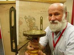
Georgina Race – Coronelli’s Globes: A view of the world

In the 17th century Vicenzo Coronelli’s made globes depicting the earth for Louis XIV and other royalty of the day. Georgina will take a look at the history of these famous globes and what they represented. She will review how effective were they for geographic representation and perspective and whether there are similar questions which can be asked of spatial information today.

Georgina is a spatial analyst specialising in water, coastal and environmental studies.  She attended the International Cartography Conference in Paris in 2011 where her interest in the globes was sparked during a cocktail party in their presence.

Chris Scott

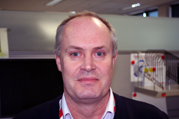
Chris Scott – Free your GIS: A journey in open source

There are many myths around Open Source GIS and their usefulness to business. Chris will explain the fallacy of these many myths while also showing us the how Open Source can be of value within the GIS environment.

Chris has been involved with GIS  for 10 years, with interests in Spatial databases, Open Source technology & Web Mapping.

Lynnette Terrett

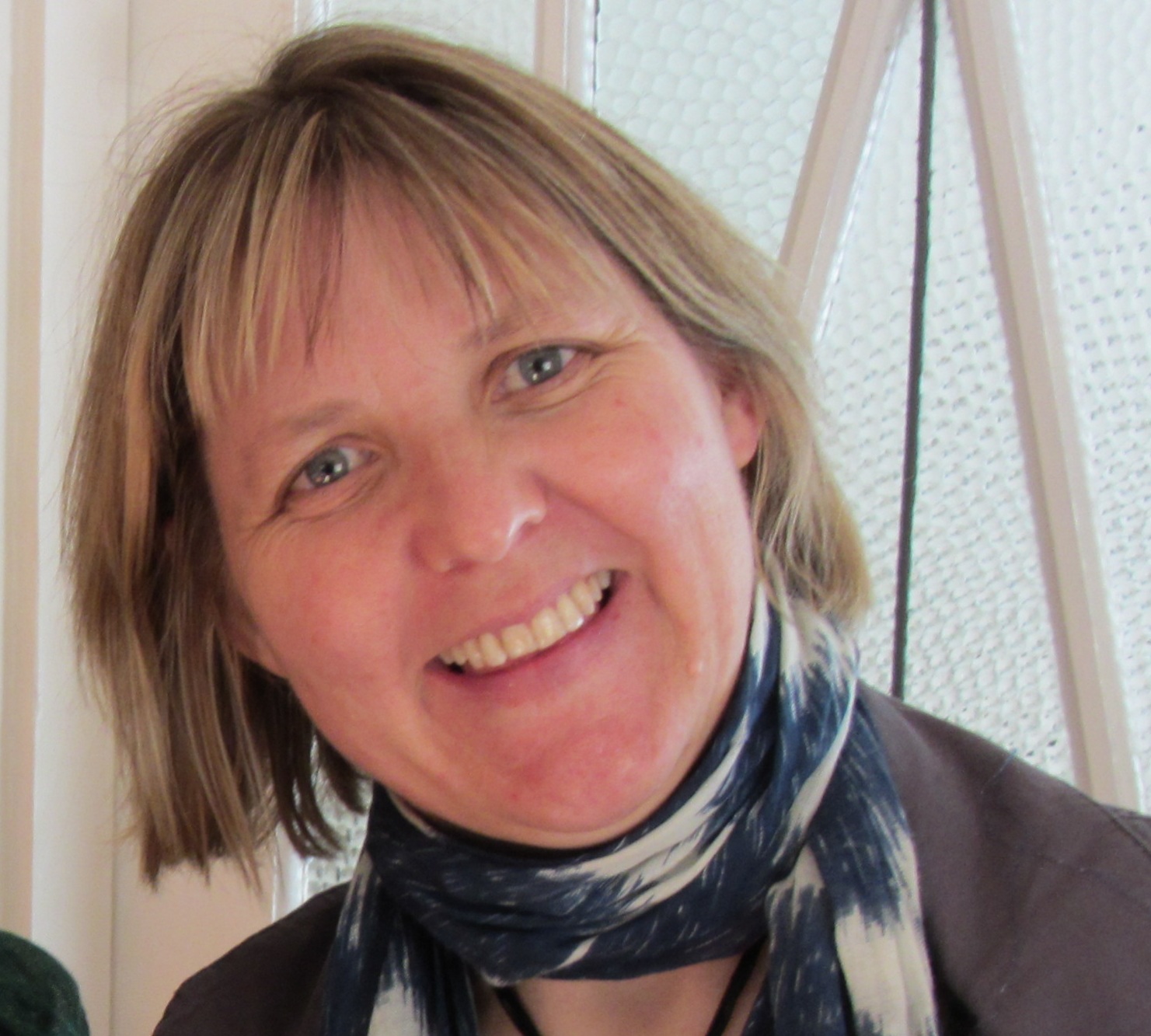
Lynnette Terrett – Destination Spatial, Skilling a Spatial Industry Workforce for the future

What is Destination Spatial and why does it exist. Lynn will provide a background of this initiative why it is important to the ongoing health and future of our industry.

Lynn is a strategic spatial technology consultant working across many Asset, Environmental, Disease, Weeds, Pest & Disaster Recovery Management projects for government and public sector. Her current passion is promoting Destination Spatial to ensure Australia grows the educational pathways to train and skill up the Geospatial workforce of tomorrow

David Parkington

David Parkinson – Identifying a mosquito in a crowd – a challenge.

The Eliminate Dengue research program is an international not-for-profit collaboration led from Monash University. The program is developing a natural approach to control the spread of dengue based on. The challenge is to introduce the Wolbachia bacteria into wild populations of the Aedes aegypti mosquito in dengue transmission areas.

David, like all geography graduates, has managed to be  employed in many roles – but in 17 years has never been “just a Geographer”.

chris_pettit1

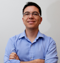
Chris Pettit – The Australian Urban Research Infrastructure Network (AURIN)

AURIN is a $20 Million initiative funded by the Australian Government’s Super Science scheme. It is tasked with providing built environment and urban researchers, designers and planners with e-infrastructure to facilitate access to a distributed network of aggregated datasets and information services. Chris will provide a background on the initiative and where it is up to.

Chris is an Associate Professor at the University of Melbourne who has a passion for all things spatial. In his free time he is also the Chair of the Victorian Region SSSI and of the IPRS working group on Geographical Visualization and Virtual Reality.

Steve Bennett

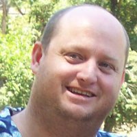
Steve Bennett – Open Street Map Cycle Hack

Steve is a  software engineer, project manager, business analyst, technical writer, system administrator, technical analyst, project administrator and opinionateur in the Australian e-Research sector. He currently works at the Victorian e-Research Strategic Initiative, implementing data management systems for researchers.


If you haven’t registered yet to listen to these fantastic speakers and the opportunity to network with your fellow GeoRabblers then do so now at http://georabble-melb.eventbrite.com

Topics for GeoRabble Sydney (11th April)

omnilinklogo

Thanks to our sponsor Omnilink, following are the speakers for the next Sydney GeoRabble.

Llew Cain

Llew Cain – Are we 2D living in a 6D Future? A shed perspective.

Micromine, Surpac, Datamine, 3D Geomodeller, Vulcan, GoCAD, VRML, X3D, GIS, Vertical Mapper, Discover 3D, Target, Revit, BIM, ProjectWise, iModels, 3D PDF, Infrastructure Designer, CityEngine, WebGL, HTML5. Is it topology, clash detection or geodesign? Multi dimensional design has always been around in the mining industry, and more recently growing in engineering and architecture, what are the implications for GIS people? Is there is a paradigm shift just around the corner. Will the average GIS operator still be relevant in a future where analysis, understanding and communication are done in true 3D, 4D, 5D, 6D space? While taking a moment in the shed to ponder the big questions a comforting realisation is achieved. Or is it?

Matthew_Smith

Matthew Smith – Fires near Me mobile app

Fires near Me was an experiment. An experiment first in whether the public had a taste for this type of information delivered through a mobile device. The information was short and to the point — much like a focused sound bite in modern mainstream media. Indentifying the audience correctly allows content, app and map interaction, and information presentation to be tailored more precisely, giving greater user satisfaction.

Mobile app interaction with available networks, back-end data servers, and onboard functions (e.g. GPS) needs careful design in order to develop a useable architecture. Architecture for a non-finite — and mostly uncontrollable — user base must be fundamental to the app design.

Developers of mobile apps — certainly in 2010 — were less experienced in application development than is the case for other, enterprise application development. This requires more involvement in the design phase and closer management of the development and support phases.

Executive support tends to come after success with a launched product, rather than before a research and development project, and also needs careful management.

JodyGarnett

Jody Garnett – Business Intelligence and Mapping (with cartoons and demo)

A quick look at business intelligence industry: who they are, their perspective on life, and why they are investing in mapping technologies. Illustrated (cartoons) with a demo of smashing maps into the open source BIRT project.

StephenLead

Stephen Lead – Esri’s 100-lines-or-less competition

In our industry we’re used to overblown and over-complicated mapping portals, which aim to solve every possible problem which could apply to every possible user.

In a refreshing twist, Esri launched a contest to design the exact opposite – a focussed mapping application built using a maximum of 100 lines of JavaScript code. Some of the entries were very simple, while some were extremely clever.

This talk will cover the best entries in the competition, plus some brief behind-the-scenes of the data scraping exercise in my own entry, which was a visualisation of the climate of Australia, using data obtained from 1,500 BOM weather stations.

MarkWarton

Mark Warton – Mobile apps for the Easter Show

Building an geospatial type App for one of Australia’s largest Events should not be too hard? Right? Let me take you on a quick journey of the challenges of building an App in a short time frame, for a  large event where spatial content is only being confirmed just days before the event.

NarelleIrvine

Narelle Irvine – Mapping Kosciuszko Huts

Narelle has been involved for many years with the Kosciuszko Huts Association – a group that maintains the old cattlemen’s huts scattered throughout the park. When a webmap  showing the huts became desirable, Narelle volunteered. She embarked on a self-education program to understand and use open source mapping tools.

chris_broadfoot

Chris Broadfoot – Tracking with the Google Maps Android API

GeoRabble Brisbane #3 Speaker #5 – Bill Thomson

BillThomson
“It’s more than just maps!”

Not everyone has geospatial intelligence!

No, it’s not an oxymoron.  GEOINT is the military discipline that exploits imagery and geospatial data in order to support decision making and operations.

That doesn’t mean it is always used well.  For some military flavour this close to ANZAC Day, Bill Thomson will provide some geo-insights and lessons from events at Gallipoli through to Iraq.

As a former military engineer officer, Bill commanded geospatial troops in Australia and on operations overseas, including demining, disaster response, UAVs and counter terrorism.  He is now the GIS Director and BIM Taskforce Leader for AECOM (ANZ).

Remaining FREE tickets available from http://georabblebrisbane3.eventbrite.com.au

The event is generously sponsored by …

GIS Recruitment GR Logo-colour on White AAM Logo

Speakers confirmed for GeoRabble Sydney #6

We have a great line up for our next Sydney GeoRabble, with another burst of interesting talks about all aspects of geo, guaranteed to be free of sales pitches. Confirmed speakers are:

  • Llew Cain – Are we 2D living in a 6D future?
  • Jody Garnett – Business intelligence and mapping
  • Mark Warton – Mobile apps for the Easter Show
  • Matthew Smith – About the Fires Near Me mobile app
  • Stephen Lead – Esri’s 100-lines-or-less competition
  • Chris Broadfoot – What’s new in the Google Maps API

Date: Thursday 11th April
Time: 5.30 pm for 6.00 pm start
Location: Occidental Hotel, 43 York St
Grab your tickets from georabblesydney6.eventbrite.com – as always it’s free, with no membership fees.

See you there!

Brisbane GeoRabble #3 Speaker #4 – Ben Somerville

ImageWhen not sailing himself, or maintaining a web map devoted to the Brisbane to Gladstone Yacht Race, Ben Somerville is well known to ArcGIS users as an early adopter and advocate of Esri’s developer and server technologies.

As Spatial Systems Manager at Thiess, Ben is responsible for the management of a GIS that supports many projects across multiple disciplines and platforms. Ben currently spends most of his time supporting the Silcar Thiess Services joint venture which is designing and constructing the NBN in Qld, NSW and the ACT.

For GeoRabble Brisbane #3 Ben is planning to share his thoughts on managing large field work forces and the impact the NBN could have on the GIS industry.

Remaining FREE tickets available from http://georabblebrisbane3.eventbrite.com.au

Speaker #3 for GeoRabble Brisbane #3 – Deb Polson

ImageDungeon Masters of the Real World

Our streets and cities are being transformed into fictional worlds, through the imagination and tools of mobile game designers.  They see your surroundings as the new arena for play, and your pocket device as the new interface for adventure.  This presentation will show some of the latest innovations in location-aware games, and how you can participate in this emerging practice as both a player and a developer.

Deb Polson is a lecturer in Communication Design at Qld University of Technology.  She is also the Director of Newish Media, and an independent game designer.

At last count only 13 tickets left at http://www.eventbrite.com.au/event/5434396426#

Speaker #2 for GeoRabble Brisbane #3 – Bill Kitson

BillKitson
Photo from http://caboolture-shire-herald.whereilive.com.au/news/story/kitson-wins-prestigious-award/

GeoRabble Brisbane is honoured to welcome Bill Kitson to our spatial gathering!

Bill Kitson is one of Queensland’s best known surveyors and a highly respected spatial historian.

Following a 1974 Survey Office investigation of the surviving markers along the Queensland State borders, Bill became ‘hooked on history’ researching the lives and work of the men that mapped Queensland. This interest in heritage became his vocation in 1980 when he was appointed as curator of the then newly established Lands, Mapping and Surveying Museum.

Even in retirement Bill continues to be a prolific and highly effective communicator. His passion for preserving surveying heritage and his generosity in sharing his unsurpassed knowledge of the spatial industry have become legendary.

His talk will be titled ‘Surveying Heritage, Our Glorious Past’.

At last count only 16 tickets left at http://www.eventbrite.com.au/event/5434396426#

Registrations Open for GeoRabble Melbourne #4

GeoRabble is back in Melbourne on Tuesday 23rd April at the European Bier Cafe (120 Exhibition St) with drinks, free food and geo-talks. Doors open 5:30pm, presentations start 6:30pm.

The line up of guest speakers are being finalised and we still have room for 1-2 more speakers, so let us know if you have a geo-story that you would like share. We are looking for interesting, entertaining or downright geeky presenters. If you fit that category, and have a geo-story to tell us then email your ideas to melbourne@georabble.org

Registration is now open and attendance is free so RSVP at  georabble-melb.eventbrite.com.au

A very special thanks to our GeoAwesome AAM Sponsor without whom we couldn’t run this event and provide food to everyone …

Image

Esri’s 100-lines-or-less competition

Esri are running a coding competition, with the challenge being to write a fully-functional JavaScript map using a maximum of 100 lines of code.

I love this idea, as it’s the functional equivalent of a good GeoRabble talk – cut the crap and get straight to the point. Even better, they’re using GitHub to manage the entries, which makes each entry public so other people can learn from it. The full details of the competition are at https://github.com/Esri/100-lines-or-less-js

I decided to give it a go – my entry is available here.

Climate Explorer

In order to make it Australian-focussed, I wanted to use the BOM’s climate datasets. Unfortunately I don’t think there’s an easy way to obtain this data, so I wrote a Python script to scrape the data from the site. I’m not sure of the legality of this, but my conscience is clear as it’s just an automated way of getting to publicly accessible information. Hopefully they feel the same way…

Once I had downloaded the information, I made a point featureclass from it, and served it out via ArcGIS Server. My entry is basically a wrapper to make it easy to find weather stations and see their historical records. A link underneath the charts takes your directly to that weather station’s data feed. This is arguably easier and more intuitive than having to look up a station number, as at http://www.bom.gov.au/climate/data

I’d love to add more functionality, but I’m already dangerously close to the 100 line limit. Please let me know of any feedback.

Cheers,
Steve (@stephenlead)