GeoRabble Brisbane held its fourth GeoEvent on Tuesday the 27th of August at the Pig N Whistle (Riverside).
Peter Scarth – Open Source, Open Data, Mapping Beer?
Massive amounts of really important data is languishing in the drawers and shelves and disk drives of people all over the world. Data that is on paper, or in poorly documented proprietary formats, is not useable unless heaps of time is invested in re-coding it. I’ll be talking about our field data collection solution, the open source “Open Data Kit” (ODK), which works both in Mobile Devices and as offline HTML5 forms. It’s well documented, it’s fast, it’s easy, it’s cloud, it’s live, it’s spatial, it’s awesome. Data and metadata have never been so exciting.

@PeteScarth used to cut firewood and build geodesic domes. Foolishly, he went back to university and now works for the Joint Remote Sensing Research Program, a collaborative research program bring together three state governments and the University of Queensland. He’s a FOSS tinkerer, opendata facilitator, cyclist, remote sensing scientist and hardware hacker.
Stewart Hay – Are your online maps really reaching everyone?
Online maps are increasingly being used for presenting extensive amounts of information to the public. But are online map accessible to everyone?
Stewart will take a look at how online mapping solutions fail to consider people with accessibility difficulties, why this is important and what can be done about it.

Stewart is the Principal Consultant for OneSphere and likes to help organisations get the best out of their GIS investment. His experience encompasses a range of industries from Environmental Management and Utilities to Emergency Services and all tiers of Government. During his free time he helps organise the Melbourne and Sydney GeoRabbles.
Graeme Browning – Story Mapping for Family History
Working with Esri software since long before ArcGIS was a glint in Jack Dangermond’s eye, Graeme Browning is well known to users of that software, but he also has a more recent and strong interest in genealogy.
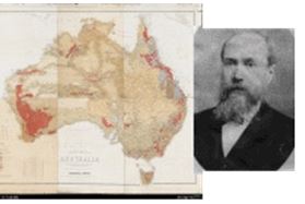
For GeoRabble Brisbane #4, Graeme will share a proof of concept ArcGIS for Desktop technique by presenting a Story Map on his 3rd great grandfather, William Slight, who was an early Australian map engraver.
Rob Bischof – Leveraging Your Worth

Phil Punter – There’s been an incident at Roma Street
Most of us who travel by train will have heard an announcement such as ”Passengers are informed, trains are delayed because of an incident at Roma Street……”. Whilst there are many times we don’t find out why these things have happened, sometimes, the impact of these incidents is large enough to warrant a publicly available report. This talk is about one of these incidents, its impact and its underlying cause. From this, one important concept is revealed regarding asset management using spatial technologies.

We are very pleased to have Phil Punter, Principal GIS Consultant from Parsons Brinckerhoff coming to speak. For anyone who does not know Phil, he now brings his expert knowledge, developed using every generation of Esri’s internet mapping technologies (ArcView IMS, ArcIMS and ArcGIS Server), to bear upon Engineering, Transportation and Utilities points of pain
Nathan Woodrow — Contributing to an open source project
What is it like to be a developer on a popular open source project? Nathan will share his experience of joining and contributing to the fast moving QGIS project, and what it’s like to be an open source developer.

It is going to be a fantastic night! If you haven’t already registered yet and you think (as we do) that the speakers are going to be great then feel free to book your ticket NOW!
We are always interested in hearing about what is new and exciting in spatial, so if you’d like to speak at an event, let the organisers know what you think the GeoRabble could learn from you! We are keen to receive any and all “abstracts” or draft slides that outline your talk idea so just make contact with your nearest GeoRabble organiser of choice.
![]()
GeoRabble Brisbane #4 is sponsored by Mipela GeoSolutions
